Area Overview for SG8 7RE
Photos of SG8 7RE
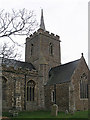
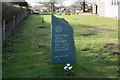
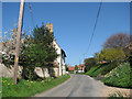
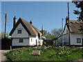
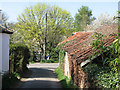
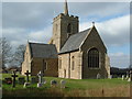
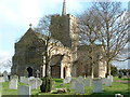
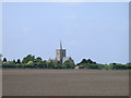
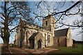
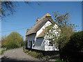
100 photos from this area
Area Information
Key information about the SG8 7RE including its size, population, and administrative classification.
- Area Type
- Postcode
- Area Size
- 1.5 km²
- Population
- 1501
- Population Density
- 103 people/km²
House Prices in SG8 7RE
49
Properties
£787,115
Average Sold Price
£136,000
Lowest Price
£1,855,000
Highest Price
Showing 49 properties
| Address | Type | Beds | Baths | Last Sale Price | Last Sale Date | |
|---|---|---|---|---|---|---|
| 48 Church Street, Thriplow, SG8 7RE | house | - | - | £1,245,000 | Jul 2024 | |
| 32 Church Street, Thriplow, SG8 7RE | Bungalow | - | - | £849,000 | Jun 2021 | |
| 21 Church Street, Thriplow, SG8 7RE | house | 5 | 3 | £1,100,000 | Nov 2020 | |
| 9 Church Street, Thriplow, SG8 7RE | house | - | - | £272,000 | Mar 2020 | |
| 38 Church Street, Thriplow, SG8 7RE | house | - | - | £935,000 | Nov 2019 | |
| 17 Church Street, Thriplow, SG8 7RE | house | - | - | £865,000 | Oct 2019 | |
| 59 Church Street, Thriplow, SG8 7RE | house | - | - | £1,250,000 | Jul 2019 | |
| 1 Church Street, Thriplow, SG8 7RE | house | - | - | £840,250 | Nov 2018 | |
| 34 Church Street, Thriplow, SG8 7RE | house | - | - | £1,300,000 | Oct 2018 | |
| 19 Church Street, Thriplow, SG8 7RE | house | - | - | £1,150,000 | Jul 2018 |
Page 1 of 5
Energy Efficiency in SG8 7RE
Amenities
Schools
| Rank | School | Type | Entry gender | Ages |
|---|
Explore more schools in this area
Go to Schools tabDemographics
Household Size
Family (3-5 people)
most common
Accommodation Type
Houses
most common
Tenure
76
majority
Ethnic Group
White
most common
Religion
N/A
most common
Household Composition
N/A
most common
Age
47
median
Adults (30-64 years)
most common
Household Deprivation
N/A
with no deprivation
NS-SEC
49
in Lower managerial occupations
Explore more demographic insights in this area
Go to Demographics tabPlanning
Planning Constraints
- Flood RiskPremium
- Ramsar Wetland SitesPremium
- Area of Outstanding Natural BeautyPremium
- Protected Nature ReservePremium
- Protected WoodlandPremium