Area Overview for SG8 7QT
Photos of SG8 7QT
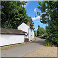
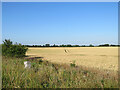
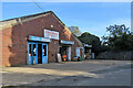
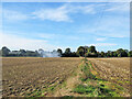
55 photos from this area
Area Information
Key information about the SG8 7QT including its size, population, and administrative classification.
- Area Type
- Postcode
- Area Size
- 19.4 hectares
- Population
- 1501
- Population Density
- 103 people/km²
House Prices in SG8 7QT
18
Properties
£349,500
Average Sold Price
£200,000
Lowest Price
£450,000
Highest Price
Showing 18 properties
| Address | Type | Beds | Baths | Last Sale Price | Last Sale Date | |
|---|---|---|---|---|---|---|
| Fieldside, Thriplow Road, Fowlmere, SG8 7QT | Bungalow | - | - | £415,000 | Aug 2020 | |
| Ballymore, Thriplow Road, Fowlmere, SG8 7QT | Bungalow | 3 | - | £439,000 | Oct 2017 | |
| 4 Thriplow Road, Fowlmere, SG8 7QT | Semi-detached | 3 | 1 | £208,000 | Oct 2014 | |
| Grange View, Thriplow Road, Fowlmere, SG8 7QT | Bungalow | 5 | - | £392,000 | May 2013 | |
| 2 Thriplow Road, Fowlmere, SG8 7QT | Semi-detached | 2 | 1 | £200,000 | Nov 2010 | |
| Wetherlee, Thriplow Road, Fowlmere, SG8 7QT | house | - | - | £440,000 | Oct 2007 | |
| 6 Thriplow Road, Fowlmere, SG8 7QT | Bungalow | 2 | - | £450,000 | Oct 2007 | |
| Linburn, Thriplow Road, Fowlmere, SG8 7QT | Detached | - | - | £297,000 | Mar 2007 | |
| Walnut House, Thriplow Road, Fowlmere, SG8 7QT | Detached | - | - | £365,000 | May 2004 | |
| Burnaby, Thriplow Road, Fowlmere, SG8 7QT | Detached | - | - | £330,000 | May 2003 |
Page 1 of 2
Energy Efficiency in SG8 7QT
Amenities
Schools
| Rank | School | Type | Entry gender | Ages |
|---|
Explore more schools in this area
Go to Schools tabDemographics
Household Size
Family (3-5 people)
most common
Accommodation Type
Houses
most common
Tenure
76
majority
Ethnic Group
White
most common
Religion
N/A
most common
Household Composition
N/A
most common
Age
47
median
Adults (30-64 years)
most common
Household Deprivation
N/A
with no deprivation
NS-SEC
49
in Lower managerial occupations
Explore more demographic insights in this area
Go to Demographics tabPlanning
Planning Constraints
- Flood RiskPremium
- Ramsar Wetland SitesPremium
- Area of Outstanding Natural BeautyPremium
- Protected Nature ReservePremium
- Protected WoodlandPremium