Area Overview for SG8 6NX
Photos of SG8 6NX
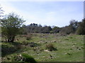
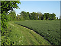
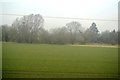
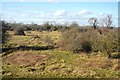
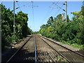
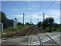
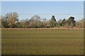
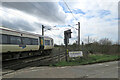
51 photos from this area
Area Information
Key information about the SG8 6NX including its size, population, and administrative classification.
- Area Type
- Postcode
- Area Size
- 6.2 hectares
- Population
- 1109
- Population Density
- 127 people/km²
House Prices in SG8 6NX
16
Properties
£506,850
Average Sold Price
£177,000
Lowest Price
£1,505,000
Highest Price
Showing 16 properties
| Address | Type | Beds | Baths | Last Sale Price | Last Sale Date | |
|---|---|---|---|---|---|---|
| 99B North End, Meldreth, SG8 6NX | house | 2 | 1 | £256,500 | May 2024 | |
| 97 North End, Meldreth, SG8 6NX | Detached | 4 | 3 | £1,505,000 | Sep 2022 | |
| 99D North End, Meldreth, SG8 6NX | Terraced | 1 | 1 | £177,000 | Mar 2016 | |
| 113 North End, Meldreth, SG8 6NX | Cottage | 4 | - | £390,000 | Mar 2015 | |
| 99C North End, Meldreth, SG8 6NX | house | 2 | 1 | £205,000 | Feb 2014 | |
| 101 North End, Meldreth, SG8 6NX | Detached | 5 | 3 | £690,000 | Jan 2011 | |
| 97B North End, Meldreth, SG8 6NX | Detached | - | - | £760,000 | Aug 2009 | |
| 99A North End, Meldreth, SG8 6NX | Detached | - | - | £184,000 | Feb 2008 | |
| 111 North End, Meldreth, SG8 6NX | Semi-detached | - | - | £276,000 | Mar 2005 | |
| 107 North End, Meldreth, SG8 6NX | house | - | - | £625,000 | Sep 2003 |
Page 1 of 2
Energy Efficiency in SG8 6NX
Amenities
Schools
| Rank | School | Type | Entry gender | Ages |
|---|
Explore more schools in this area
Go to Schools tabDemographics
Household Size
Two person
most common
Accommodation Type
Houses
most common
Tenure
77
majority
Ethnic Group
White
most common
Religion
N/A
most common
Household Composition
N/A
most common
Age
47
median
Adults (30-64 years)
most common
Household Deprivation
N/A
with no deprivation
NS-SEC
49
in Lower managerial occupations
Explore more demographic insights in this area
Go to Demographics tabPlanning
Planning Constraints
- Flood RiskPremium
- Ramsar Wetland SitesPremium
- Area of Outstanding Natural BeautyPremium
- Protected Nature ReservePremium
- Protected WoodlandPremium