Area Overview for SG8 5AB
Photos of SG8 5AB
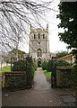
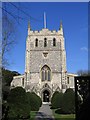
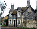
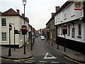
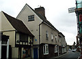
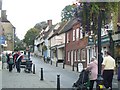
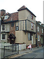

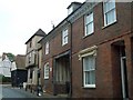
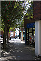
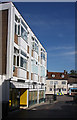
100 photos from this area
Area Information
Key information about the SG8 5AB including its size, population, and administrative classification.
- Area Type
- Postcode
- Area Size
- 1.9 hectares
- Population
- Not available
- Population Density
- Not available
House Prices in SG8 5AB
21
Properties
£624,333
Average Sold Price
£205,000
Lowest Price
£1,199,000
Highest Price
Showing 21 properties
| Address | Type | Beds | Baths | Last Sale Price | Last Sale Date | |
|---|---|---|---|---|---|---|
| 23 Kneesworth Street, Royston, SG8 5AB | Terraced | 6 | - | £1,199,000 | Feb 2016 | |
| 32 Kneesworth Street, Royston, SG8 5AB | Detached | - | - | £469,000 | Aug 2004 | |
| 34 Kneesworth Street, Royston, SG8 5AB | Land | 5 | 3 | £205,000 | Nov 1996 | |
| 28 Kneesworth Street, Royston, SG8 5AB | Terraced | 5 | 2 | - | - | |
| 34C Kneesworth Street, Royston, SG8 5AB | Detached | 5 | 5 | - | - | |
| 1, Chester Court, Kneesworth Street, Royston, SG8 5AB | Semi-detached | 2 | - | - | - | |
| 2, Chester Court, Kneesworth Street, Royston, SG8 5AB | Bungalow | - | - | - | - | |
| 34D Kneesworth Street, Royston, SG8 5AB | Detached | 3 | 2 | - | - | |
| Flat, 36 Kneesworth Street, Royston, SG8 5AB | Flat | 1 | 1 | - | - | |
| 34A Kneesworth Street, Royston, SG8 5AB | Detached | - | - | - | - |
Page 1 of 3
Energy Efficiency in SG8 5AB
Amenities
Schools
| Rank | School | Type | Entry gender | Ages |
|---|
Explore more schools in this area
Go to Schools tabDemographics
Household Size
One person
most common
Accommodation Type
Houses
most common
Tenure
61
majority
Ethnic Group
White
most common
Religion
N/A
most common
Household Composition
N/A
most common
Age
47
median
Adults (30-64 years)
most common
Household Deprivation
N/A
with no deprivation
NS-SEC
46
in Lower managerial occupations
Explore more demographic insights in this area
Go to Demographics tabPlanning
Planning Constraints
- Flood RiskPremium
- Ramsar Wetland SitesPremium
- Area of Outstanding Natural BeautyPremium
- Protected Nature ReservePremium
- Protected WoodlandPremium