Area Overview for SG7 6LR
Photos of SG7 6LR
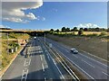
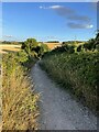
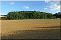
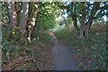
23 photos from this area
Area Information
Key information about the SG7 6LR including its size, population, and administrative classification.
- Area Type
- Postcode
- Area Size
- 18.3 hectares
- Population
- 2066
- Population Density
- 33 people/km²
House Prices in SG7 6LR
81
Properties
£184,846
Average Sold Price
£60,000
Lowest Price
£422,500
Highest Price
Showing 81 properties
| Address | Type | Beds | Baths | Last Sale Price | Last Sale Date | |
|---|---|---|---|---|---|---|
| 1B Woodland Way, Baldock, SG7 6LR | Terraced | 1 | 1 | £125,000 | Mar 2025 | |
| 9 Woodland Way, Baldock, SG7 6LR | house | - | - | £422,500 | Oct 2023 | |
| 12 Woodland Way, Baldock, SG7 6LR | house | - | - | £332,000 | Dec 2019 | |
| 6 Woodland Way, Baldock, SG7 6LR | house | - | - | £400,000 | Feb 2017 | |
| 1 Woodland Way, Baldock, SG7 6LR | house | - | - | £170,000 | May 2015 | |
| 92 Woodland Way, Baldock, SG7 6LR | Semi-detached | 2 | 2 | £74,000 | Aug 2010 | |
| 91 Woodland Way, Baldock, SG7 6LR | house | - | - | £74,000 | Aug 2010 | |
| 5 Woodland Way, Baldock, SG7 6LR | Semi-detached | - | - | £244,000 | Apr 2010 | |
| 1C Woodland Way, Baldock, SG7 6LR | Terraced | - | - | £125,000 | Sep 2009 | |
| 14 Woodland Way, Baldock, SG7 6LR | house | - | - | £155,000 | Sep 2002 |
Page 1 of 9
Energy Efficiency in SG7 6LR
Amenities
Schools
| Rank | School | Type | Entry gender | Ages |
|---|
Explore more schools in this area
Go to Schools tabDemographics
Household Size
Two person
most common
Accommodation Type
Houses
most common
Tenure
69
majority
Ethnic Group
White
most common
Religion
N/A
most common
Household Composition
N/A
most common
Age
47
median
Adults (30-64 years)
most common
Household Deprivation
N/A
with no deprivation
NS-SEC
45
in Lower managerial occupations
Explore more demographic insights in this area
Go to Demographics tabPlanning
Planning Constraints
- Flood RiskPremium
- Ramsar Wetland SitesPremium
- Area of Outstanding Natural BeautyPremium
- Protected Nature ReservePremium
- Protected WoodlandPremium