Area Overview for SG7 6BY
Photos of SG7 6BY
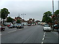
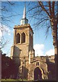
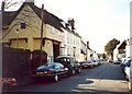
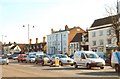
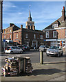
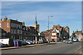
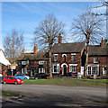


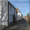
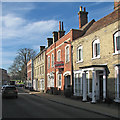
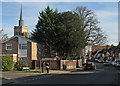
73 photos from this area
Area Information
Key information about the SG7 6BY including its size, population, and administrative classification.
- Area Type
- Postcode
- Area Size
- 6575 m²
- Population
- 1547
- Population Density
- 4484 people/km²
House Prices in SG7 6BY
21
Properties
£259,308
Average Sold Price
£33,500
Lowest Price
£540,000
Highest Price
Showing 21 properties
| Address | Type | Beds | Baths | Last Sale Price | Last Sale Date | |
|---|---|---|---|---|---|---|
| 10 South Road, Baldock, SG7 6BY | Terraced | 3 | 2 | £430,000 | Aug 2025 | |
| 8 South Road, Baldock, SG7 6BY | house | 3 | 2 | £420,000 | Oct 2021 | |
| 26 South Road, Baldock, SG7 6BY | house | - | - | £540,000 | Oct 2020 | |
| 20 South Road, Baldock, SG7 6BY | Semi-detached | 3 | 1 | £395,000 | Dec 2018 | |
| 28 South Road, Baldock, SG7 6BY | house | 4 | 2 | £216,888 | Aug 2009 | |
| 32 South Road, Baldock, SG7 6BY | Semi-detached | 3 | - | £205,000 | Dec 2008 | |
| 12 South Road, Baldock, SG7 6BY | Detached | - | - | £330,000 | Jun 2006 | |
| 5 South Road, Baldock, SG7 6BY | house | - | - | £155,500 | Jul 2005 | |
| 3 South Road, Baldock, SG7 6BY | Terraced | - | - | £54,000 | Sep 1996 | |
| 18 South Road, Baldock, SG7 6BY | Semi-detached | - | - | £72,500 | Feb 1996 |
Page 1 of 3
Energy Efficiency in SG7 6BY
Amenities
Schools
| Rank | School | Type | Entry gender | Ages |
|---|
Explore more schools in this area
Go to Schools tabDemographics
Household Size
Two person
most common
Accommodation Type
Houses
most common
Tenure
83
majority
Ethnic Group
White
most common
Religion
N/A
most common
Household Composition
N/A
most common
Age
47
median
Adults (30-64 years)
most common
Household Deprivation
N/A
with no deprivation
NS-SEC
45
in Lower managerial occupations
Explore more demographic insights in this area
Go to Demographics tabPlanning
Planning Constraints
- Flood RiskPremium
- Ramsar Wetland SitesPremium
- Area of Outstanding Natural BeautyPremium
- Protected Nature ReservePremium
- Protected WoodlandPremium