Area Overview for SG6 4DQ
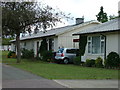
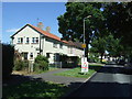
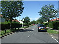
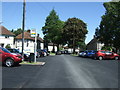
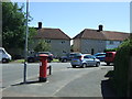
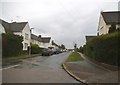
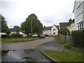
Photos of SG6 4DQ
Area Information
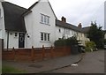
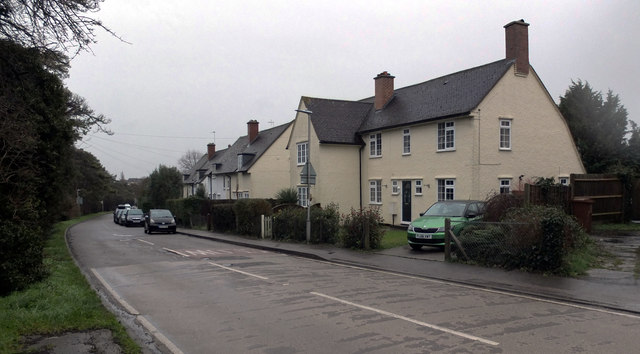
Living in SG6 4DQ means residing within a compact residential cluster covering just 1.2 hectares. This small footprint houses 1,629 residents, creating a tightly knit neighbourhood where daily life involves navigating close proximity among neighbours. The area exists as a specific postcode boundary that defines a distinct part of the wider local landscape. You will find yourself in a space that prioritises density over sprawl, situated in England where the housing stock is predominantly housed rather than detached or semi-detached. The concentration of people per square kilometre stands at 136,422, indicating a high-density urban environment typical of certain postcodes. Daily routines revolve around accessibility rather than extensive travel, with key amenities and transport links placed within practical reach. This locality offers a straightforward living experience defined by clear boundaries and an immediate sense of community. For those considering homes in SG6 4DQ, the layout suggests a lifestyle where everything is reachable without long commutes. The area represents a functional slice of suburban life that balances residential needs with access to essential services. Your day-to-day experience will be shaped by this concentrated population and the specific character of this postcode.
- Area Type
- Postcode
- Area Size
- 1.2 hectares
- Population
- 1629
- Population Density
- 2538 people/km²
Homes in SG6 4DQ are primarily houses, which distinguishes this postcode from areas dominated by high-rise flats or townhouses. The accommodation type data shows a strong focus on traditional residential structures suitable for families or individuals seeking garden space. However, the low home ownership rate of 37% creates a market dynamic where renting remains a common arrangement. You may find that properties change hands frequently as tenants move on before securing a mortgage. This high turnover contrasts with the physical stability of the house stock itself. The small size of the area, at just 1.2 hectares, means that supply is limited, which can affect price fluctuations. When viewing properties, expect to see a concentration of standard housing designs typical of the region. The mix of owner-occupiers and renter households suggests a diverse economic base within this small cluster. For buyers, this specific postcode offers a chance to enter the housing market in a built-up area where demand often outstrips the available supply of detached or semi-detached units.
House Prices in SG6 4DQ
Showing 51 properties
| Address | Type | Beds | Baths | Last Sale Price | Last Sale Date | |
|---|---|---|---|---|---|---|
| 60 Lindsell Avenue, Letchworth Garden City, SG6 4DQ | Semi-detached | 4 | 2 | £385,000 | Feb 2025 | |
| 40 Lindsell Avenue, Letchworth Garden City, SG6 4DQ | Maisonette | 1 | 1 | £245,000 | Feb 2025 | |
| 76 Lindsell Avenue, Letchworth Garden City, SG6 4DQ | house | 3 | 2 | £410,000 | Nov 2024 | |
| 58 Lindsell Avenue, Letchworth Garden City, SG6 4DQ | Terraced | 3 | 2 | £375,000 | Nov 2024 | |
| 8 Lindsell Avenue, Letchworth Garden City, SG6 4DQ | house | 3 | 1 | £450,000 | Jun 2024 | |
| 90 Lindsell Avenue, Letchworth Garden City, SG6 4DQ | Terraced | 2 | 1 | £330,000 | May 2024 | |
| 66 Lindsell Avenue, Letchworth Garden City, SG6 4DQ | Semi-detached | 3 | 3 | £470,000 | Apr 2024 | |
| 62 Lindsell Avenue, Letchworth Garden City, SG6 4DQ | Terraced | 2 | 1 | £328,000 | Oct 2023 | |
| 68 Lindsell Avenue, Letchworth Garden City, SG6 4DQ | Terraced | 2 | 1 | £330,000 | Aug 2023 | |
| 44 Lindsell Avenue, Letchworth Garden City, SG6 4DQ | Terraced | 4 | 2 | £470,000 | Feb 2023 |
Energy Efficiency in SG6 4DQ
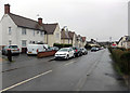
Your daily lifestyle in SG6 4DQ benefits from immediate access to major retail chains and rail hubs. Five key amenities lie close by, specifically including Tesco Letchworth, Morrisons Lordship, and Sainsburys Letchworth. These supermarkets ensure that grocery shopping is a short walk or quick drive away. You do not need to plan shopping trips weeks in advance; the choice between these three major retailers provides convenience wherever you choose to shop. Transport connectivity is further enhanced by five nearby railway stations, including Letchworth, Hitchin, and Baldock. This network allows you to reach wider parts of the country easily from your doorstep. The area is woven into a web of commuting routes that connects you to major employment centres. With several shops and train lines at your fingertips, the routine of running errands becomes efficient rather than time-consuming. Living in SG6 4DQ means you have the high street experience without the suburban isolation, as large known retailers sit just a short distance from your home.
Amenities
Schools
Families considering SG6 4DQ will find two primary schools within practical reach that serve the local community. Icknield Infant and Nursery School holds a satisfactory Ofsted rating and serves the younger demographic. Nearby, Fearnhill School operates as a primary institution and carries a good Ofsted rating. This combination offers a straightforward educational pathway for young children living in the area. The presence of both schools suggests that families do not need to travel far to secure schooling for their offspring. The mix of satisfactory and good ratings indicates that while options are available, performance levels vary slightly between institutions. Parents researching schools near SG6 4DQ should verify which school zone boundaries align with their specific address, as these details are defined by the local authority. Both schools are located close enough to be part of daily routines for residents. The proximity of these educational facilities supports families who prioritise short commutes to school gates each morning.
| Rank | School | Type | Entry gender | Ages |
|---|
Explore more schools in this area
Go to Schools tabDemographics
The community in SG6 4DQ is defined by a mature population profile with a median age of 47 years. Adults aged between 30 and 64 form the most common age range, suggesting a neighbourhood anchored by working families and established households. You are looking at an area with significant rental pressure, as only 37% of residents own their homes directly. This low ownership rate indicates a dynamic market where many people rent while living in predominantly houses. The demographic makeup is mostly White, reflecting the broader patterns of the region. With nearly half the residents falling into the 30-64 bracket, the area feels stable yet active. The high population density creates an energy that you would not find in rural parishes. This age structure means local shops see consistent footfall throughout the week. Buyers looking at homes in SG6 4DQ should note that they are entering a space where long-term residents mix with those seeking affordable rental options before settling into ownership.
Household Size
Accommodation Type
Tenure
Ethnic Group
Religion
Household Composition
Age
Household Deprivation
NS-SEC
Explore more demographic insights in this area
Go to Demographics tabPlanning
Planning Constraints
- Flood RiskPremium
- Ramsar Wetland SitesPremium
- Area of Outstanding Natural BeautyPremium
- Protected Nature ReservePremium
- Protected WoodlandPremium