Area Overview for SG6 4AB
Photos of SG6 4AB


Area Information
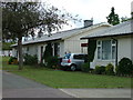
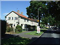
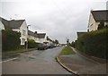
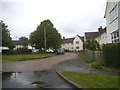
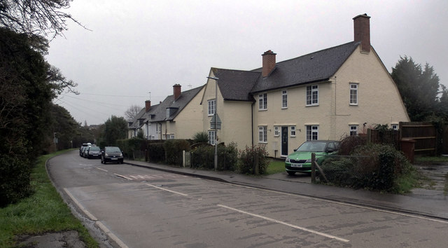
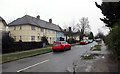
Living in SG6 4AB offers a settled residential experience within a post code cluster housing approximately 1,270 people. This specific area sits confidently in the UK's garden cities, providing a quiet domestic atmosphere distinct from the busy urban centres nearby. You will find a Judicious mix of residents seeking space and stability away from immediate city chaos. Daily life here revolves around a well-defined neighbourhood where pace is controlled and domestic privacy is standard. The location serves as a practical base for those working in nearby towns while wanting a home environment free from commercial noise. Real people create the character of this postcode, and the community benefits from strong local ties. The housing stock reflects a desire for traditional living standards rather than high-rise density. You can expect a lifestyle focused on local access and established routines rather than rapid change. This area functions as a solid anchor point for families and professionals alike. The simplicity of the residential layout allows you to focus on your immediate surroundings without the distraction of large-scale development projects nearby. It is a place where you know your neighbours and where the rhythm of daily life remains consistent year after year.
- Area Type
- Postcode
- Area Size
- Not available
- Population
- 1270
- Population Density
- 4221 people/km²
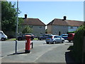
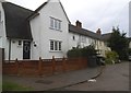
The property market in SG6 4AB is defined by a strong preference for houses rather than flats or apartments. With 59% home ownership rates, the area functions primarily as an owner-occupied market rather than a rental estate. You will find most properties are family homes purchased for long-term residence rather than investment holdings. This high percentage indicates that buyers have secured their positions within the local housing stock and intend to remain for considerable periods. The nature of the accommodation suggests a demand for detached or semi-detached properties typical of this region. For buyers looking at this small postcode area, the market reflects a desire for stability and space. The dominance of house ownership means fewer vacant units are available for rent, keeping vacancy rates low and letting demand steady. Prospective purchasers should anticipate dealing with established owners rather than landlords. The stock is built around traditional architectural styles suited to the local landscape. This environment discourages speculative building and favours existing structures that meet local planning standards. You are entering a market where sellers typically know their property well and have lived there for a time. The lack of rental relevance means pricing reflects long-term value rather than short-term turnover. This situation benefits those seeking a permanent home rather than a temporary address.
House Prices in SG6 4AB
No properties found in this postcode.
Energy Efficiency in SG6 4AB
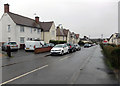
Your daily lifestyle in SG6 4AB includes immediate access to major retail chains and rail transport links. Within practical reach, you can reach Tesco Letchworth, Morrisons Lordship, and Sainsburys Letchworth for all your shopping requirements. These three supermarkets ensure you have no long journey to stock up your home or grab groceries on the way home from work. The availability of multiple options means you can choose your preferred retailer for specific needs or price points. Shopping trips remain quick and convenient without the strain of traveling to distant centres. Rail connectivity is equally accessible with Letchworth Railway Station, Hitchin Railway Station, and Baldock Railway Station nearby. These stations provide direct links to wider travel networks for commuting or weekend getaways. You can reach the rest of the country quickly without needing a private vehicle for every journey. The combination of nearby shops and railway links creates a balanced lifestyle where convenience meets connectivity. Residents enjoy the benefits of city-centre amenities without the associated density or noise. This practical arrangement supports a straightforward daily routine focused on efficiency and comfort.
Amenities
Schools
| Rank | School | Type | Entry gender | Ages |
|---|
Explore more schools in this area
Go to Schools tabDemographics
The community in SG6 4AB skews towards mature residents with a median age of 47. Adults between thirty and sixty-four years old form the most common age range across the postcode. This demographic profile indicates a neighbourhood dominated by households with significant life experience and financial stability. Home ownership stands at 59%, meaning more than half of the residents own their properties outright or with a mortgage. This high rate suggests long-term residency and a desire for stability rather than short-term renting arrangements. Houses comprise the predominant form of accommodation, aligning with the preference for traditional living spaces over flats or apartments. You will find that the local population consists largely of White British residents, reflecting the broader national trend but maintaining a clear ethnic majority in this specific cluster. The demographic data points to a stable, established community rather than a transient population. There are no young families or students creating shifting fluctuations in population numbers. Instead, the area hosts a consistent group of individuals who value privacy, space, and a quieter existence. These figures collectively describe a neighbourhood where the primary residents are settled adults seeking a calm domestic life away from the hustle of younger demographics.
Household Size
Accommodation Type
Tenure
Ethnic Group
Religion
Household Composition
Age
Household Deprivation
NS-SEC
Explore more demographic insights in this area
Go to Demographics tabPlanning
Planning Constraints
- Flood RiskPremium
- Ramsar Wetland SitesPremium
- Area of Outstanding Natural BeautyPremium
- Protected Nature ReservePremium
- Protected WoodlandPremium