Area Overview for SG6 2EG
Photos of SG6 2EG
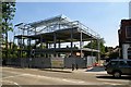
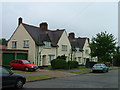
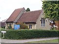
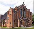
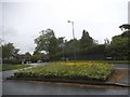
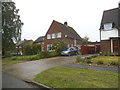
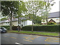
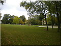
47 photos from this area
Area Information
Key information about the SG6 2EG including its size, population, and administrative classification.
- Area Type
- Postcode
- Area Size
- 3953 m²
- Population
- 1469
- Population Density
- 2977 people/km²
House Prices in SG6 2EG
8
Properties
£348,875
Average Sold Price
£80,500
Lowest Price
£480,000
Highest Price
Showing 8 properties
| Address | Type | Beds | Baths | Last Sale Price | Last Sale Date | |
|---|---|---|---|---|---|---|
| 66 Baldock Road, Letchworth Garden City, SG6 2EG | house | - | - | £410,000 | Apr 2024 | |
| 113 Baldock Road, Letchworth Garden City, SG6 2EG | house | - | - | £425,000 | Nov 2020 | |
| 68 Baldock Road, Letchworth Garden City, SG6 2EG | Semi-detached | 3 | 1 | £480,000 | Feb 2019 | |
| 121 Baldock Road, Letchworth Garden City, SG6 2EG | Terraced | - | - | £80,500 | Feb 1995 | |
| 64 Baldock Road, Letchworth Garden City, SG6 2EG | house | - | - | - | - | |
| 119 Baldock Road, Letchworth Garden City, SG6 2EG | Terraced | - | - | - | - | |
| 115 Baldock Road, Letchworth Garden City, SG6 2EG | Terraced | - | - | - | - | |
| 117 Baldock Road, Letchworth Garden City, SG6 2EG | Detached | - | - | - | - |
Energy Efficiency in SG6 2EG
Amenities
Schools
| Rank | School | Type | Entry gender | Ages |
|---|
Explore more schools in this area
Go to Schools tabDemographics
Household Size
Two person
most common
Accommodation Type
Houses
most common
Tenure
92
majority
Ethnic Group
White
most common
Religion
N/A
most common
Household Composition
N/A
most common
Age
47
median
Adults (30-64 years)
most common
Household Deprivation
N/A
with no deprivation
NS-SEC
53
in Lower managerial occupations
Explore more demographic insights in this area
Go to Demographics tabPlanning
Planning Constraints
- Flood RiskPremium
- Ramsar Wetland SitesPremium
- Area of Outstanding Natural BeautyPremium
- Protected Nature ReservePremium
- Protected WoodlandPremium