Area Overview for SG6 2DP
Photos of SG6 2DP
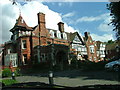
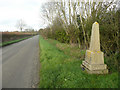
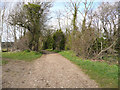
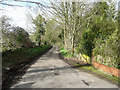
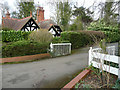
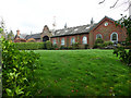
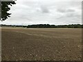
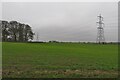

13 photos from this area
Area Information
Key information about the SG6 2DP including its size, population, and administrative classification.
- Area Type
- Postcode
- Area Size
- 22.6 hectares
- Population
- 1273
- Population Density
- 381 people/km²
House Prices in SG6 2DP
16
Properties
£274,190
Average Sold Price
£205,000
Lowest Price
£350,000
Highest Price
Showing 16 properties
| Address | Type | Beds | Baths | Last Sale Price | Last Sale Date | |
|---|---|---|---|---|---|---|
| 11, Roxley Manor, Roxley Court Road, Willian, SG6 2DP | Flat | 2 | 2 | £350,000 | Jul 2023 | |
| 15, Roxley Manor, Roxley Court Road, Willian, SG6 2DP | Flat | 2 | 2 | £250,000 | Mar 2019 | |
| 14, Roxley Manor, Roxley Court Road, Willian, SG6 2DP | Flat | 2 | 2 | £281,000 | Jul 2017 | |
| 12, Roxley Manor, Roxley Court Road, Willian, SG6 2DP | Flat | - | - | £284,950 | Aug 2004 | |
| 16, Roxley Manor, Roxley Court Road, Willian, SG6 2DP | Flat | 2 | 2 | £205,000 | Mar 2002 | |
| 6, Roxley Manor, Roxley Court Road, Willian, SG6 2DP | Terraced | 3 | 2 | - | - | |
| 2, Roxley Manor, Roxley Court Road, Willian, SG6 2DP | Retail | 2 | 2 | - | - | |
| Former Roxley Court, Roxley Court Road, Willian, SG6 2DP | undefined | - | - | - | - | |
| 1, Roxley Manor, Roxley Court Road, Willian, SG6 2DP | Terraced | - | - | - | - | |
| 7, Roxley Manor, Roxley Court Road, Willian, SG6 2DP | Flat | - | - | - | - |
Page 1 of 2
Energy Efficiency in SG6 2DP
Amenities
Schools
| Rank | School | Type | Entry gender | Ages |
|---|
Explore more schools in this area
Go to Schools tabDemographics
Household Size
Two person
most common
Accommodation Type
Houses
most common
Tenure
77
majority
Ethnic Group
White
most common
Religion
N/A
most common
Household Composition
N/A
most common
Age
47
median
Adults (30-64 years)
most common
Household Deprivation
N/A
with no deprivation
NS-SEC
45
in Lower managerial occupations
Explore more demographic insights in this area
Go to Demographics tabPlanning
Planning Constraints
- Flood RiskPremium
- Ramsar Wetland SitesPremium
- Area of Outstanding Natural BeautyPremium
- Protected Nature ReservePremium
- Protected WoodlandPremium