Area Overview for SG5 4WN
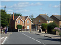
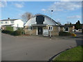
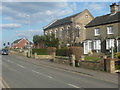
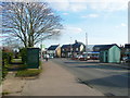
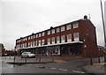
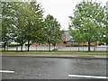
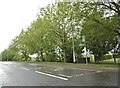
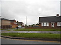
Photos of SG5 4WN


Area Information
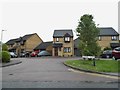
Living in SG5 4WN defines residence within a small, tightly knit residential cluster in England. This specific postcode area accommodates a population of 2,554 residents across a compact footprint. The result is a living environment with a population density of 828 people per square kilometre. This figure indicates a neighbourhood where facilities are relatively close, yet the setting avoids the congestion typical of larger urban centres. The area functions as a focused settlement rather than a sprawling development. Daily life here revolves around the practicalities of this concentrated population. You will find a community where residents know their immediate surroundings well. The layout supports a quiet existence, distinct from the high-rise density found elsewhere in the county. Prospective buyers consider this postcode for its manageable scale and specific residential character. It represents a microcosm of life in the surrounding rural districts. The environment is defined by its size and density rather than expansive parklands or industrial zones. Understanding the capacity of SG5 4WN is key to deciding if this cluster fits your requirements for a home.
- Area Type
- Postcode
- Area Size
- Not available
- Population
- 2554
- Population Density
- 828 people/km²
The property market in SG5 4WN is characterised almost entirely by owner-occupied housing. With 82% of the population owning their homes, the area is not a rental market but a settlement of settled residents. The predominant accommodation type comprises houses, which fits the profile of a family-oriented cluster. This high ownership percentage often translates to a slower-changing housing stock where long-term residents remain in place. Buyers looking at this postcode should expect traditional house types rather than the rental properties common in university towns or London commuter belts. The fact that this specific postcode covers a small residential cluster means individual street profiles can be examined closely. When purchasing homes in SG5 4WN, you are entering an area with deep roots. The market reflects stability rather than transient investment. If you are seeking a place to stay for many years, the high ownership rate supports that intention. The data confirms a focus on residential purchase history rather than short-term lettings. This makes SG5 4WN a suitable choice for buyers prioritising permanence over market speculation.
House Prices in SG5 4WN
No properties found in this postcode.
Energy Efficiency in SG5 4WN
Daily lifestyle in SG5 4WN benefits from amenities located within practical reach of residents. For shopping, five retail options are nearby. Notable venues include the Co-op in Stotfold and M&S in Baldock. The area also offers a Tesco in Fairfield. These specific stores provide essential goods and daily shopping needs without requiring long drives. For commuters and rail users, five railway stations serve the area. The Arlesey, Baldock, and Letchworth Railway Stations are the specific nodes mentioned for local transport. These venues integrate retail convenience with access to the wider rail network. Living in SG5 4WN means having supermarket and high street options readily accessible. The presence of M&S and Tesco indicates a range of product availability from grocery items to household goods. Dining and leisure activities are supported by the high street presence in Stotfold and Baldock. You do not need to travel far for basic commercial services. The proximity of these specific shops and stations creates a functional layout for daily life. Residents can combine errands with a train journey easily. This balance of local and regional access defines the convenience of the area.
Amenities
Schools
Families in SG5 4WN have access to three specific educational institutions serving the local community. Roecroft Lower School operates as a primary school with an Ofsted rating of satisfactory. St Mary's VC Lower School is also a primary option. For further education, children can attend St Mary's CofE Academy Stotfold, which an academy type school. This academy holds a good Ofsted rating. The presence of a school with a good rating provides a strong educational anchor for the neighbourhood. The mix includes primary education and a larger academy, meaning younger children attend smaller local provisions while older pupils join the main academy. Schools near SG5 4WN therefore offer a continuum from primary through to secondary education. You will find that primary education is covered by two distinct institutions, providing choice for younger families. The combination of a satisfactory and a good-rated institution suggests a balanced educational landscape. Parents researching options will find both a local primary and a larger academy within reach. This configuration supports families moving into the area with school-aged children.
| Rank | School | Type | Entry gender | Ages |
|---|
Explore more schools in this area
Go to Schools tabDemographics
The demographic profile of SG5 4WN reveals a mature community focused on households with adults. The median age stands at 47 years old. Most commonly, the population consists of adults falling within the 30 to 64 years range. This age distribution suggests a settled neighbourhood rather than a transient student housing hub. House ownership is the dominant accommodation type, with 82% of residents owning their homes. Consequently, the area functions primarily as an owner-occupied zone. The predominant ethnic group is White, reflecting the broader cultural makeup of the region. There are no indications of significant diversity shifts within this specific postcode boundary. The high ownership rate contributes to long-term stability in the area. Families and established individuals define the social fabric. Deprivation metrics are not listed in the available information for this specific cluster, so no qualitative judgement is possible based on official indices. Instead, the data highlights a stable, older demographic with strong roots in the locality. This profile aligns with buyers seeking established homes rather than new-build developments for first-time tenants.
Household Size
Accommodation Type
Tenure
Ethnic Group
Religion
Household Composition
Age
Household Deprivation
NS-SEC
Explore more demographic insights in this area
Go to Demographics tabPlanning
Planning Constraints
- Flood RiskPremium
- Ramsar Wetland SitesPremium
- Area of Outstanding Natural BeautyPremium
- Protected Nature ReservePremium
- Protected WoodlandPremium