Area Overview for SG5 4SP
Photos of SG5 4SP
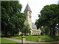

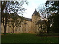

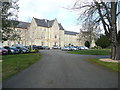

31 photos from this area
Area Information
Key information about the SG5 4SP including its size, population, and administrative classification.
- Area Type
- Postcode
- Area Size
- 2.4 hectares
- Population
- 2893
- Population Density
- 1172 people/km²
House Prices in SG5 4SP
43
Properties
£479,921
Average Sold Price
£305,000
Lowest Price
£680,000
Highest Price
Showing 43 properties
| Address | Type | Beds | Baths | Last Sale Price | Last Sale Date | |
|---|---|---|---|---|---|---|
| 36 Darwin Lane, Fairfield, SG5 4SP | Flat | - | - | £320,000 | Jan 2025 | |
| 15 Darwin Lane, Fairfield, SG5 4SP | Detached | 4 | 2 | £305,000 | Jun 2024 | |
| 17 Darwin Lane, Fairfield, SG5 4SP | house | - | - | £479,950 | Apr 2024 | |
| 7 Darwin Lane, Fairfield, SG5 4SP | house | - | - | £520,000 | Apr 2024 | |
| 9 Darwin Lane, Fairfield, SG5 4SP | house | - | - | £539,500 | Apr 2024 | |
| 5 Darwin Lane, Fairfield, SG5 4SP | house | - | - | £515,000 | Feb 2024 | |
| 21 Darwin Lane, Fairfield, SG5 4SP | house | - | - | £680,000 | Jul 2023 | |
| 34 Darwin Lane, Fairfield, SG5 4SP | Detached | 3 | 2 | - | - | |
| 38 Darwin Lane, Fairfield, SG5 4SP | Semi-detached | 3 | 2 | - | - | |
| 39 Darwin Lane, Fairfield, SG5 4SP | Semi-detached | 3 | 2 | - | - |
Page 1 of 5
Energy Efficiency in SG5 4SP
Amenities
Schools
| Rank | School | Type | Entry gender | Ages |
|---|
Explore more schools in this area
Go to Schools tabDemographics
Household Size
Family (3-5 people)
most common
Accommodation Type
Houses
most common
Tenure
81
majority
Ethnic Group
White
most common
Religion
N/A
most common
Household Composition
N/A
most common
Age
47
median
Adults (30-64 years)
most common
Household Deprivation
N/A
with no deprivation
NS-SEC
52
in Lower managerial occupations
Explore more demographic insights in this area
Go to Demographics tabPlanning
Planning Constraints
- Flood RiskPremium
- Ramsar Wetland SitesPremium
- Area of Outstanding Natural BeautyPremium
- Protected Nature ReservePremium
- Protected WoodlandPremium