Area Overview for SG5 4GY
Photos of SG5 4GY
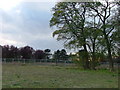

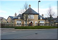

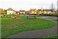
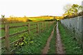
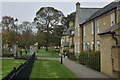
9 photos from this area
Area Information
Key information about the SG5 4GY including its size, population, and administrative classification.
- Area Type
- Postcode
- Area Size
- 2.3 hectares
- Population
- 1534
- Population Density
- 5652 people/km²
House Prices in SG5 4GY
33
Properties
£283,963
Average Sold Price
£102,500
Lowest Price
£475,000
Highest Price
Showing 33 properties
| Address | Type | Beds | Baths | Last Sale Price | Last Sale Date | |
|---|---|---|---|---|---|---|
| 15 Kipling Crescent, Fairfield, SG5 4GY | Maisonette | 2 | 1 | £335,000 | Feb 2025 | |
| 22 Kipling Crescent, Fairfield, SG5 4GY | Flat | - | - | £270,000 | Aug 2022 | |
| 10 Kipling Crescent, Fairfield, SG5 4GY | Flat | - | - | £325,000 | Jul 2022 | |
| 26 Kipling Crescent, Fairfield, SG5 4GY | Terraced | 3 | 2 | £380,000 | Jun 2021 | |
| 20 Kipling Crescent, Fairfield, SG5 4GY | house | - | - | £397,500 | Feb 2021 | |
| 12 Kipling Crescent, Fairfield, SG5 4GY | Flat | - | - | £125,000 | Jan 2021 | |
| 3 Kipling Crescent, Fairfield, SG5 4GY | house | - | - | £425,000 | Dec 2020 | |
| 29 Kipling Crescent, Fairfield, SG5 4GY | house | - | - | £175,000 | Jul 2020 | |
| 21 Kipling Crescent, Fairfield, SG5 4GY | Semi-detached | 4 | 3 | £430,000 | Nov 2019 | |
| 35 Kipling Crescent, Fairfield, SG5 4GY | Terraced | 2 | 1 | £280,000 | Dec 2018 |
Page 1 of 4
Energy Efficiency in SG5 4GY
Amenities
Schools
| Rank | School | Type | Entry gender | Ages |
|---|
Explore more schools in this area
Go to Schools tabDemographics
Household Size
Family (3-5 people)
most common
Accommodation Type
Houses
most common
Tenure
73
majority
Ethnic Group
White
most common
Religion
N/A
most common
Household Composition
N/A
most common
Age
47
median
Adults (30-64 years)
most common
Household Deprivation
N/A
with no deprivation
NS-SEC
56
in Lower managerial occupations
Explore more demographic insights in this area
Go to Demographics tabPlanning
Planning Constraints
- Flood RiskPremium
- Ramsar Wetland SitesPremium
- Area of Outstanding Natural BeautyPremium
- Protected Nature ReservePremium
- Protected WoodlandPremium