Area Overview for SG5 4FT
Photos of SG5 4FT
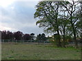
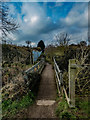
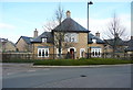

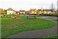
9 photos from this area
Area Information
Key information about the SG5 4FT including its size, population, and administrative classification.
- Area Type
- Postcode
- Area Size
- 8803 m²
- Population
- 1534
- Population Density
- 5652 people/km²
House Prices in SG5 4FT
27
Properties
£364,305
Average Sold Price
£205,000
Lowest Price
£665,000
Highest Price
Showing 27 properties
| Address | Type | Beds | Baths | Last Sale Price | Last Sale Date | |
|---|---|---|---|---|---|---|
| 153 Bronte Avenue, Fairfield, SG5 4FT | Semi-detached | 3 | 2 | £460,000 | Dec 2024 | |
| 141 Bronte Avenue, Fairfield, SG5 4FT | house | 4 | 2 | £665,000 | Feb 2024 | |
| 151 Bronte Avenue, Fairfield, SG5 4FT | Semi-detached | 3 | 2 | £485,000 | Oct 2023 | |
| 121 Bronte Avenue, Fairfield, SG5 4FT | Terraced | 3 | 2 | £425,000 | Jun 2023 | |
| 149 Bronte Avenue, Fairfield, SG5 4FT | house | - | - | £500,000 | Dec 2022 | |
| 133 Bronte Avenue, Fairfield, SG5 4FT | Terraced | 3 | 2 | £385,000 | May 2021 | |
| 129 Bronte Avenue, Fairfield, SG5 4FT | Terraced | 3 | 2 | £425,000 | Mar 2021 | |
| 145 Bronte Avenue, Fairfield, SG5 4FT | Semi-detached | 3 | 2 | £397,000 | Jan 2018 | |
| 123 Bronte Avenue, Fairfield, SG5 4FT | Semi-detached | 4 | 2 | £476,000 | Oct 2017 | |
| 54 Bronte Avenue, Fairfield, SG5 4FT | house | - | - | £369,950 | Jun 2016 |
Page 1 of 3
Energy Efficiency in SG5 4FT
Amenities
Schools
| Rank | School | Type | Entry gender | Ages |
|---|
Explore more schools in this area
Go to Schools tabDemographics
Household Size
Family (3-5 people)
most common
Accommodation Type
Houses
most common
Tenure
73
majority
Ethnic Group
White
most common
Religion
N/A
most common
Household Composition
N/A
most common
Age
47
median
Adults (30-64 years)
most common
Household Deprivation
N/A
with no deprivation
NS-SEC
56
in Lower managerial occupations
Explore more demographic insights in this area
Go to Demographics tabPlanning
Planning Constraints
- Flood RiskPremium
- Ramsar Wetland SitesPremium
- Area of Outstanding Natural BeautyPremium
- Protected Nature ReservePremium
- Protected WoodlandPremium