Area Overview for SG5 4EN
Photos of SG5 4EN

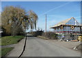
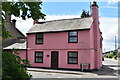


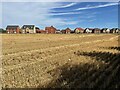
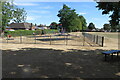


19 photos from this area
Area Information
Key information about the SG5 4EN including its size, population, and administrative classification.
- Area Type
- Postcode
- Area Size
- 9.7 hectares
- Population
- 1788
- Population Density
- 3648 people/km²
House Prices in SG5 4EN
32
Properties
£151,291
Average Sold Price
£40,000
Lowest Price
£246,500
Highest Price
Showing 32 properties
| Address | Type | Beds | Baths | Last Sale Price | Last Sale Date | |
|---|---|---|---|---|---|---|
| 83 Vaughan Road, Stotfold, SG5 4EN | Flat | - | - | £185,000 | Feb 2019 | |
| 99 Vaughan Road, Stotfold, SG5 4EN | Maisonette | 2 | - | £220,000 | Jan 2019 | |
| 109 Vaughan Road, Stotfold, SG5 4EN | Flat | - | - | £140,000 | Oct 2014 | |
| 70 Vaughan Road, Stotfold, SG5 4EN | Semi-detached | 3 | - | £210,000 | Dec 2013 | |
| 103 Vaughan Road, Stotfold, SG5 4EN | Maisonette | - | - | £133,500 | Oct 2013 | |
| 105 Vaughan Road, Stotfold, SG5 4EN | Maisonette | - | - | £125,000 | Aug 2013 | |
| 111 Vaughan Road, Stotfold, SG5 4EN | Flat | - | - | £143,500 | Jan 2013 | |
| 97 Vaughan Road, Stotfold, SG5 4EN | Flat | - | - | £129,000 | Nov 2012 | |
| 71 Vaughan Road, Stotfold, SG5 4EN | house | - | - | £150,000 | Dec 2011 | |
| 77 Vaughan Road, Stotfold, SG5 4EN | Terraced | 4 | - | £240,000 | Jun 2011 |
Page 1 of 4
Energy Efficiency in SG5 4EN
Amenities
Schools
| Rank | School | Type | Entry gender | Ages |
|---|
Explore more schools in this area
Go to Schools tabDemographics
Household Size
Family (3-5 people)
most common
Accommodation Type
Houses
most common
Tenure
63
majority
Ethnic Group
White
most common
Religion
N/A
most common
Household Composition
N/A
most common
Age
47
median
Adults (30-64 years)
most common
Household Deprivation
N/A
with no deprivation
NS-SEC
31
in Lower managerial occupations
Explore more demographic insights in this area
Go to Demographics tabPlanning
Planning Constraints
- Flood RiskPremium
- Ramsar Wetland SitesPremium
- Area of Outstanding Natural BeautyPremium
- Protected Nature ReservePremium
- Protected WoodlandPremium