Area Overview for SG5 4EA
Photos of SG5 4EA

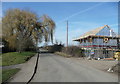
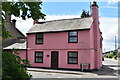


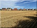
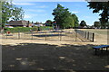


19 photos from this area
Area Information
Key information about the SG5 4EA including its size, population, and administrative classification.
- Area Type
- Postcode
- Area Size
- 1.3 hectares
- Population
- 2154
- Population Density
- 525 people/km²
House Prices in SG5 4EA
46
Properties
£267,238
Average Sold Price
£118,000
Lowest Price
£570,000
Highest Price
Showing 46 properties
| Address | Type | Beds | Baths | Last Sale Price | Last Sale Date | |
|---|---|---|---|---|---|---|
| 56 Regent Street, Stotfold, SG5 4EA | Terraced | 2 | 1 | £306,000 | Nov 2025 | |
| 32 Regent Street, Stotfold, SG5 4EA | Terraced | 2 | 1 | £300,000 | Jan 2025 | |
| 60 Regent Street, Stotfold, SG5 4EA | Terraced | 3 | 1 | £295,000 | Nov 2024 | |
| 52 Regent Street, Stotfold, SG5 4EA | Semi-detached | 3 | 1 | £420,000 | May 2024 | |
| 45 Regent Street, Stotfold, SG5 4EA | house | - | - | £300,000 | May 2023 | |
| 58 Regent Street, Stotfold, SG5 4EA | house | - | - | £295,000 | Sep 2021 | |
| 24 Regent Street, Stotfold, SG5 4EA | Detached | 3 | 2 | £570,000 | Oct 2020 | |
| 50 Regent Street, Stotfold, SG5 4EA | house | 2 | - | £300,000 | Dec 2019 | |
| 62B Regent Street, Stotfold, SG5 4EA | Flat | - | - | £190,000 | Jul 2019 | |
| 48 Regent Street, Stotfold, SG5 4EA | Semi-detached | 2 | 1 | £295,000 | Mar 2018 |
Page 1 of 5
Energy Efficiency in SG5 4EA
Amenities
Schools
| Rank | School | Type | Entry gender | Ages |
|---|
Explore more schools in this area
Go to Schools tabDemographics
Household Size
Family (3-5 people)
most common
Accommodation Type
Houses
most common
Tenure
82
majority
Ethnic Group
White
most common
Religion
N/A
most common
Household Composition
N/A
most common
Age
47
median
Adults (30-64 years)
most common
Household Deprivation
N/A
with no deprivation
NS-SEC
41
in Lower managerial occupations
Explore more demographic insights in this area
Go to Demographics tabPlanning
Planning Constraints
- Flood RiskPremium
- Ramsar Wetland SitesPremium
- Area of Outstanding Natural BeautyPremium
- Protected Nature ReservePremium
- Protected WoodlandPremium