Area Overview for SG5 3XE
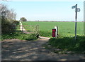
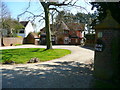
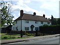
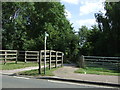
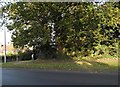
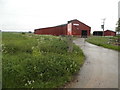
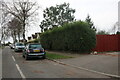
Photos of SG5 3XE


Area Information
Living in SG5 3XE means residing within a postcode area that covers a small residential cluster in England. The population stands at 2,358 individuals, creating a neighbourhood with moderate density of 305 people per square kilometre. This specific cluster offers a residential focus without the overwhelming scale of larger urban centres. You will find a community where daily life revolves around local interaction and practical convenience rather than high-rise anonymity. The area functions as a settled enclave where residents know their immediate surroundings. This distinct identity makes SG5 3XE an attractive option for those seeking a contained living environment. The small population facilitates a close-knit atmosphere while maintaining access to wider regional facilities. You are stepping into a setting defined by its residential nature and manageable size. The geography supports a quiet existence away from heavy traffic flows yet remains close to necessary services. Every aspect of daily life in this postcode reflects a balance between privacy and access. The area serves as a viable home base for families and individuals who prioritise a stable, well-defined locality.
- Area Type
- Postcode
- Area Size
- Not available
- Population
- 2358
- Population Density
- 305 people/km²
The property market in SG5 3XE is characterised by a stock dominated by houses. With 64% of residents owning their homes, the area leans heavily towards owner-occupation rather than the private rental sector. You will find that the housing landscape consists mainly of detached or semi-detached properties suitable for families or individuals seeking their own space. This high ownership percentage suggests a stable market where residents are often staying put or making measured moves rather than frequent turnovers seen in investment-heavy zones. Buying a home here means joining a community where the majority have invested in their own residences. The concentration of house types means there are fewer conversion projects or luxury apartments available. Prospective buyers should expect to look for traditional property types that match the established character of the lane. This market reality supports a quieter buying experience with less pressure to compete against landlords. The nature of the housing stock reflects the area's function as a permanent residential settlement rather than a commuter dormitory.
House Prices in SG5 3XE
No properties found in this postcode.
Energy Efficiency in SG5 3XE
Residents of SG5 3XE have access to a range of amenities within practical reach. For shopping needs, five retail venues serve the community, including Asda Nightingale, Sainsburys Hitchin, and Waitrose Hitchin. These supermarkets offer everything from fresh groceries to household essentials and savings on daily bills. Travel by train is also convenient with five railway stations located nearby. Hitchin Railway Station, Letchworth Railway Station, and Arlesey Railway Station provide links to wider destinations. You can combine local amenities with regional travel to create a balanced weekly routine. The presence of major supermarket chains in Hitchin means you do not need to leave the immediate district for significant shopping trips. Train access opens up opportunities for leisure trips or business travel to London and beyond. Your lifestyle in SG5 3XE blends the charm of a small residential cluster with the convenience of established retail and transport hubs.
Amenities
Schools
Ickleford Primary School stands as the key educational facility nearest to SG5 3XE. It operates as a primary school and holds a 'good' Ofsted rating. This specific rating indicates that the school meets high standards in teaching and student care. For families moving into the area, this primary option provides a solid foundation for early education. The presence of a single named primary school in the immediate vicinity suggests that further education might require travel to other towns. However, the strong 'good' rating ensures that children in SG5 3XE receive quality instruction from an early age. Parents can rest assured that their children will be taught by an institution subject to rigorous quality controls. The school's location serves the local catchment area effectively. While secondary options are not listed in the immediate data, the primary schooling experience in this postcode is defined by the quality offered at Ickleford Primary School.
| Rank | School | Type | Entry gender | Ages |
|---|
Explore more schools in this area
Go to Schools tabDemographics
The community in SG5 3XE features a resident base with a median age of 47 years. The most common age range consists of adults between 30 and 64 years, indicating a mature population centre. This age profile suggests a neighbourhood established by families and professionals who have put down roots over time. Home ownership is highly prevalent at 64%, showing that the majority of people live in their own homes rather than renting. Houses form the primary accommodation type, meaning you will not encounter large blocks of flats or purpose-built rental complexes. The predominant ethnic group is White, reflecting the current demographic composition of the area. This steady demographic structure provides a predictable social environment for new arrivals. The high rate of home ownership implies long-term stability within the community. Residents here are likely focused on building equity and maintaining their properties for the future. The age distribution and ownership patterns create a cohesive group of people likely to value peaceful surroundings and reliable local services.
Household Size
Accommodation Type
Tenure
Ethnic Group
Religion
Household Composition
Age
Household Deprivation
NS-SEC
Explore more demographic insights in this area
Go to Demographics tabPlanning
Planning Constraints
- Flood RiskPremium
- Ramsar Wetland SitesPremium
- Area of Outstanding Natural BeautyPremium
- Protected Nature ReservePremium
- Protected WoodlandPremium