Area Overview for SG5 3RS
Photos of SG5 3RS
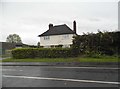
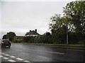
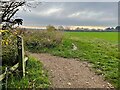
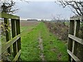
16 photos from this area
Area Information
Key information about the SG5 3RS including its size, population, and administrative classification.
- Area Type
- Postcode
- Area Size
- 71.3 hectares
- Population
- 2358
- Population Density
- 305 people/km²
House Prices in SG5 3RS
9
Properties
£575,635
Average Sold Price
£150,000
Lowest Price
£1,404,906
Highest Price
Showing 9 properties
| Address | Type | Beds | Baths | Last Sale Price | Last Sale Date | |
|---|---|---|---|---|---|---|
| Pinchgut Hall, Bedford Road, Ickleford, SG5 3RS | house | - | - | £150,000 | Jun 2021 | |
| Holme Farm, Bedford Road, Ickleford, SG5 3RS | house | - | - | £1,404,906 | May 2018 | |
| Highways, Bedford Road, Ickleford, SG5 3RS | Semi-detached | - | - | £172,000 | Jan 2002 | |
| Unit A, Pinchgut Hall, Bedford Road, Ickleford, SG5 3RS | Industrial | - | - | - | - | |
| Unit B, Pinchgut Hall, Bedford Road, Ickleford, SG5 3RS | Industrial | - | - | - | - | |
| Units C-f, Pinchgut Hall, Bedford Road, Ickleford, SG5 3RS | warehouse | - | - | - | - | |
| Little Milden, Bedford Road, Ickleford, SG5 3RS | Semi-detached | - | - | - | - | |
| Elmdene Farm, Bedford Road, Ickleford, SG5 3RS | Farm | - | - | - | - | |
| Elmdene, Bedford Road, Ickleford, SG5 3RS | house | - | - | - | - |
Energy Efficiency in SG5 3RS
Amenities
Schools
| Rank | School | Type | Entry gender | Ages |
|---|
Explore more schools in this area
Go to Schools tabDemographics
Household Size
Two person
most common
Accommodation Type
Houses
most common
Tenure
64
majority
Ethnic Group
White
most common
Religion
N/A
most common
Household Composition
N/A
most common
Age
47
median
Adults (30-64 years)
most common
Household Deprivation
N/A
with no deprivation
NS-SEC
44
in Lower managerial occupations
Explore more demographic insights in this area
Go to Demographics tabPlanning
Planning Constraints
- Flood RiskPremium
- Ramsar Wetland SitesPremium
- Area of Outstanding Natural BeautyPremium
- Protected Nature ReservePremium
- Protected WoodlandPremium