Area Overview for SG5 2JG
Photos of SG5 2JG
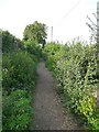
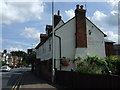

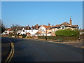
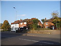
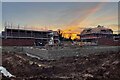
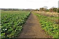
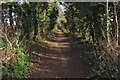
32 photos from this area
Area Information
Key information about the SG5 2JG including its size, population, and administrative classification.
- Area Type
- Postcode
- Area Size
- 1.3 hectares
- Population
- 2470
- Population Density
- 3019 people/km²
House Prices in SG5 2JG
54
Properties
£353,437
Average Sold Price
£75,000
Lowest Price
£1,250,000
Highest Price
Showing 54 properties
| Address | Type | Beds | Baths | Last Sale Price | Last Sale Date | |
|---|---|---|---|---|---|---|
| 29 Bedford Street, Hitchin, SG5 2JG | house | - | - | £640,000 | Aug 2025 | |
| 45 Bedford Street, Hitchin, SG5 2JG | Detached | 4 | 2 | £1,250,000 | Mar 2025 | |
| 25 Bedford Street, Hitchin, SG5 2JG | Terraced | 2 | 1 | £350,000 | Mar 2025 | |
| 21 Bedford Street, Hitchin, SG5 2JG | Terraced | 2 | 1 | £470,000 | Sep 2024 | |
| 1 Bedford Street, Hitchin, SG5 2JG | Terraced | 3 | 1 | £429,750 | Jul 2024 | |
| 5 Bedford Street, Hitchin, SG5 2JG | Retail | 3 | 1 | £385,000 | Jul 2022 | |
| 6 Bedford Street, Hitchin, SG5 2JG | Terraced | 3 | - | £388,000 | Sep 2021 | |
| 33 Bedford Street, Hitchin, SG5 2JG | Terraced | 2 | 2 | £427,500 | May 2021 | |
| 26 Bedford Street, Hitchin, SG5 2JG | Terraced | 2 | 1 | £373,000 | Feb 2021 | |
| 20 Bedford Street, Hitchin, SG5 2JG | Terraced | 2 | - | £416,000 | Feb 2021 |
Page 1 of 6
Energy Efficiency in SG5 2JG
Amenities
Schools
| Rank | School | Type | Entry gender | Ages |
|---|
Explore more schools in this area
Go to Schools tabDemographics
Household Size
One person
most common
Accommodation Type
Flats
most common
Tenure
58
majority
Ethnic Group
White
most common
Religion
N/A
most common
Household Composition
N/A
most common
Age
47
median
Adults (30-64 years)
most common
Household Deprivation
N/A
with no deprivation
NS-SEC
52
in Lower managerial occupations
Explore more demographic insights in this area
Go to Demographics tabPlanning
Planning Constraints
- Flood RiskPremium
- Ramsar Wetland SitesPremium
- Area of Outstanding Natural BeautyPremium
- Protected Nature ReservePremium
- Protected WoodlandPremium