Area Overview for SG5 1UG
Photos of SG5 1UG
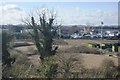
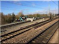
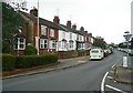
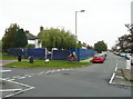
28 photos from this area
Area Information
Key information about the SG5 1UG including its size, population, and administrative classification.
- Area Type
- Postcode
- Area Size
- 1.9 hectares
- Population
- 1571
- Population Density
- 3343 people/km²
House Prices in SG5 1UG
17
Properties
£590,627
Average Sold Price
£105,000
Lowest Price
£1,280,000
Highest Price
Showing 17 properties
| Address | Type | Beds | Baths | Last Sale Price | Last Sale Date | |
|---|---|---|---|---|---|---|
| 79 Bearton Green, Hitchin, SG5 1UG | Detached | 4 | 2 | £1,280,000 | Nov 2025 | |
| 71 Bearton Green, Hitchin, SG5 1UG | Semi-detached | 4 | 2 | £875,000 | Mar 2024 | |
| 24 Bearton Green, Hitchin, SG5 1UG | Semi-detached | 3 | 2 | £975,024 | Aug 2023 | |
| 77 Bearton Green, Hitchin, SG5 1UG | house | - | - | £712,500 | Dec 2019 | |
| 18 Bearton Green, Hitchin, SG5 1UG | Detached | 3 | 3 | £700,000 | Dec 2017 | |
| 85 Bearton Green, Hitchin, SG5 1UG | Bungalow | 3 | 1 | £615,000 | Jul 2016 | |
| 73 Bearton Green, Hitchin, SG5 1UG | Semi-detached | 4 | 1 | £595,000 | Aug 2015 | |
| 81 Bearton Green, Hitchin, SG5 1UG | house | - | - | £450,000 | Aug 2010 | |
| 67 Bearton Green, Hitchin, SG5 1UG | Terraced | - | - | £312,000 | May 2009 | |
| 75 Bearton Green, Hitchin, SG5 1UG | Semi-detached | - | - | £223,000 | May 2004 |
Page 1 of 2
Energy Efficiency in SG5 1UG
Amenities
Schools
| Rank | School | Type | Entry gender | Ages |
|---|
Explore more schools in this area
Go to Schools tabDemographics
Household Size
Family (3-5 people)
most common
Accommodation Type
Houses
most common
Tenure
82
majority
Ethnic Group
White
most common
Religion
N/A
most common
Household Composition
N/A
most common
Age
47
median
Adults (30-64 years)
most common
Household Deprivation
N/A
with no deprivation
NS-SEC
54
in Lower managerial occupations
Explore more demographic insights in this area
Go to Demographics tabPlanning
Planning Constraints
- Flood RiskPremium
- Ramsar Wetland SitesPremium
- Area of Outstanding Natural BeautyPremium
- Protected Nature ReservePremium
- Protected WoodlandPremium