Area Overview for SG5 1TJ
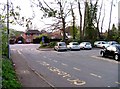
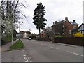
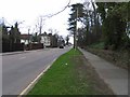
Photos of SG5 1TJ


Area Information
Living in SG5 1TJ means residing within a very small, defined residential cluster where every property is close to its neighbour. Currently, 1,561 people call this specific postcode home across a compact 6,059 square metres, creating a population density that feels intimate compared to wider Hertfordshire suburbs. The area sits squarely in the SG5 postcode sector, attracting those who prefer a tight-knit environment over sprawling developments. While the land is small, the immediate surroundings offer substantial connections to the wider network, including key rail hubs. Residents benefit from a non-statistical estimate that places them in the heart of a functioning community where daily needs are met without needing to travel far. The combination of high density and limited area size suggests a location that operates as a distinct pocket within Hitchin's broader footprint. This setup appeals to buyers who value proximity over space, knowing that shops, stations, and neighbours are steps away. The area represents a specific slice of Hertfordshire living where the built environment is concentrated and accessible.
- Area Type
- Postcode
- Area Size
- 6059 m²
- Population
- 1561
- Population Density
- 5381 people/km²
The housing stock in SG5 1TJ is defined almost entirely by houses, with almost no presence of flats or terraced townhouses. This architectural focus aligns with the demographic trend of adult ownership, where 68 percent of residents own their properties. You will find that this market operates less like a rental hub and more like a settled community where buyers look for detached or semi-built homes. The small physical size of the area, covering only 6,059 square metres, means that homes in SG5 1TJ are likely arranged in small clusters rather than large estates. This configuration often results in higher garden space per household, which owners can utilise extensively due to the 68 percent ownership rate. The lack of significant rental renting activity suggests that investors are not a major feature of this postcode. Potential buyers should focus on standard residential properties rather than expecting a mix of investment units. The dominance of owned houses creates an environment where property values tend to be held steady by owner-maintenance efforts.
House Prices in SG5 1TJ
Showing 29 properties
| Address | Type | Beds | Baths | Last Sale Price | Last Sale Date | |
|---|---|---|---|---|---|---|
| 3 Ickleford Road, Hitchin, SG5 1TJ | Terraced | 2 | 1 | £350,000 | Mar 2025 | |
| 28 Ickleford Road, Hitchin, SG5 1TJ | Terraced | 2 | 1 | £308,000 | Sep 2024 | |
| 13 Ickleford Road, Hitchin, SG5 1TJ | Terraced | 2 | 1 | £470,000 | May 2024 | |
| 2 Ickleford Road, Hitchin, SG5 1TJ | Terraced | 2 | - | £443,000 | Nov 2022 | |
| 10 Ickleford Road, Hitchin, SG5 1TJ | house | - | - | £510,000 | Aug 2022 | |
| 4 Ickleford Road, Hitchin, SG5 1TJ | house | 2 | 1 | £413,500 | Jun 2022 | |
| 14 Ickleford Road, Hitchin, SG5 1TJ | Terraced | 3 | 2 | £575,000 | Oct 2021 | |
| 5 Ickleford Road, Hitchin, SG5 1TJ | Terraced | 3 | - | £435,000 | Feb 2021 | |
| 23 Ickleford Road, Hitchin, SG5 1TJ | Semi-detached | 4 | 2 | £735,000 | Feb 2021 | |
| 24 Ickleford Road, Hitchin, SG5 1TJ | Terraced | 2 | 1 | £370,000 | Dec 2020 |
Energy Efficiency in SG5 1TJ
Your weekly shop in SG5 1TJ is a short drive or walk away from the major supermarkets. Sainsburys Hitchin, Asda Nightingale, and M&S Hitchin SF are the key retail options available to residents. These large hypermarkets mean you can buy everything from groceries to clothing without leaving the borough. For regular train travel, Hitchin Railway Station, Letchworth Railway Station, and Baldock Railway Station provide convenient links to the rest of the UK. Whether you need to unload a large parcel from Asda or catch a morning train, these facilities are practically reachable from your front door. The presence of five notable retail outlets and five railway stations within the immediate vicinity ensures that daily logistics are simple. You do not need to commute by car for routine tasks like picking up dinner or attendance at a social event at a nearby station. This layout supports a car-light lifestyle for many residents who live in SG5 1TJ. The convenience of these named stores and stations defines the daily rhythm of life here.
Amenities
Schools
For families considering living in SG5 1TJ, the only educational facility listed within immediate proximity is York Road Nursery School. This nursery serves the local community for the youngest children before they transition to primary education elsewhere. While the data does not include primary, secondary, or sixth-form colleges in this specific radius, the presence of a dedicated nursery indicates that early childhood care is integrated into the planning of this residential zone. For parents looking for schools near SG5 1TJ, they must look beyond this single institution for older pupils. The concentration of only one type of school in such a dense residential patch highlights that older children often attend institutions in neighbouring villages or towns. Families typically plan their moves based on catchment areas that extend well beyond the boundaries of this postcode. Until further data confirms the locations of older schools, prospective parents should verify catchment zones for the specific ages their children require. The nursery provides a starting point for those with infants or toddlers.
| Rank | School | Type | Entry gender | Ages |
|---|
Explore more schools in this area
Go to Schools tabDemographics
The community profile in SG5 1TJ reflects a mature demographic with a median age of 47 years. Most households consist of adults between 30 and 64 years old, indicating a settlement dominated by working professionals and established families.Ownership patterns are firmly rooted in the rental market, where 68 percent of residents own their homes outright or via a mortgage. This high ownership rate points to a stable neighbourhood where long-term residents typically stay rather than moving frequently every few years. Houses form the predominant accommodation type, meaning the streetscape features detached and semi-detached properties rather than the high-rise blocks found in urban centres. The population is predominantly White, which shapes the cultural character of the local interactions and community events. There is no record of significant deprivation within the provided data, suggesting that income levels remain generally consistent across the area. These figures, including the specific breakdown of homeownership, confirm that SG5 1TJ supports a traditional family lifestyle where stability is the norm for the majority.
Household Size
Accommodation Type
Tenure
Ethnic Group
Religion
Household Composition
Age
Household Deprivation
NS-SEC
Explore more demographic insights in this area
Go to Demographics tabPlanning
Planning Constraints
- Flood RiskPremium
- Ramsar Wetland SitesPremium
- Area of Outstanding Natural BeautyPremium
- Protected Nature ReservePremium
- Protected WoodlandPremium