Area Overview for SG5 1SQ
Photos of SG5 1SQ
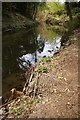
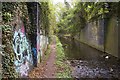
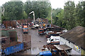
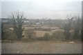
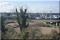
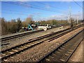
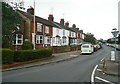
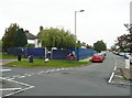
28 photos from this area
Area Information
Key information about the SG5 1SQ including its size, population, and administrative classification.
- Area Type
- Postcode
- Area Size
- 1.2 hectares
- Population
- 1396
- Population Density
- 1745 people/km²
House Prices in SG5 1SQ
12
Properties
£399,876
Average Sold Price
£230,010
Lowest Price
£625,000
Highest Price
Showing 12 properties
| Address | Type | Beds | Baths | Last Sale Price | Last Sale Date | |
|---|---|---|---|---|---|---|
| 103 Grove Road, Hitchin, SG5 1SQ | Semi-detached | 3 | - | £625,000 | Apr 2022 | |
| 93 Grove Road, Hitchin, SG5 1SQ | Detached | 4 | 2 | £495,000 | Jun 2017 | |
| 89 Grove Road, Hitchin, SG5 1SQ | Detached | 3 | - | £625,000 | May 2017 | |
| 95 Grove Road, Hitchin, SG5 1SQ | Bungalow | 3 | - | £440,000 | Jan 2015 | |
| 105 Grove Road, Hitchin, SG5 1SQ | Bungalow | 2 | 1 | £230,010 | Oct 2014 | |
| 91 Grove Road, Hitchin, SG5 1SQ | Bungalow | 2 | - | £249,999 | Aug 2013 | |
| 107 Grove Road, Hitchin, SG5 1SQ | Bungalow | 3 | - | £284,000 | Oct 2011 | |
| 97 Grove Road, Hitchin, SG5 1SQ | Bungalow | - | - | £250,000 | Oct 2010 | |
| Storage Building, Grove Road, Hitchin, SG5 1SQ | warehouse | - | - | - | - | |
| 99 Grove Road, Hitchin, SG5 1SQ | Semi-detached | - | - | - | - |
Page 1 of 2
Energy Efficiency in SG5 1SQ
Amenities
Schools
| Rank | School | Type | Entry gender | Ages |
|---|
Explore more schools in this area
Go to Schools tabDemographics
Household Size
Family (3-5 people)
most common
Accommodation Type
Houses
most common
Tenure
82
majority
Ethnic Group
White
most common
Religion
N/A
most common
Household Composition
N/A
most common
Age
47
median
Adults (30-64 years)
most common
Household Deprivation
N/A
with no deprivation
NS-SEC
47
in Lower managerial occupations
Explore more demographic insights in this area
Go to Demographics tabPlanning
Planning Constraints
- Flood RiskPremium
- Ramsar Wetland SitesPremium
- Area of Outstanding Natural BeautyPremium
- Protected Nature ReservePremium
- Protected WoodlandPremium