Area Overview for SG5 1RU
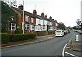
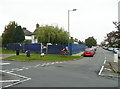
Photos of SG5 1RU


Area Information
SG5 1RU represents a specific postcode area covering a small residential cluster within the broader Hitchin region of England. With a population of 1,396, this location functions as an intimate neighbours community rather than a sprawling town centre. Residents here experience a quieter, more settled daily life compared to larger urban hubs. The area is defined by its compact nature, which fosters a sense of familiarity among neighbours while maintaining proximity to vital services in Hitchin and Letchworth. Living in SG5 1RU means relying on established road networks to access local shopping and employment opportunities. The geography is primarily residential, offering a stable environment for families and professionals who prefer a low-density setting. You do not find bustling high streets or heavy traffic congestion within this cluster, yet you retain easy access to key transport links outside your immediate bounds. This balance allows you to enjoy a calm domestic routine without complete isolation from the wider area. The defining characteristic of this postcode is its focus on housing stability and community cohesion, making it a practical choice for those seeking a quiet corner of Hertfordshire with reliable connections to nearby towns.
- Area Type
- Postcode
- Area Size
- Not available
- Population
- 1396
- Population Density
- 1745 people/km²
The property market in SG5 1RU is characterised by a strong preference for ownership rather than renting. With 82% of residents owning their homes, the area functions as an established housing estate where real estate turnover is likely driven by life events such as grow-ups or downsizing, rather than student housing or short-term tenancies. The primary accommodation type consists of Houses, which dominate the landscape of this small cluster. This means you will find semi-detached, detached, or terrace houses forming the core of the stock, with very limited high-rise flats or converted commercial units. When looking at homes in SG5 1RU, you are evaluating properties that have stood the test of time. The high ownership percentage suggests these are places where people buy to live in, not just to let. This stability often leads to better maintenance of the street scene compared to areas dominated by private landlords. Buyers should note that the market here is smaller than in larger towns because the total population is only 1,396. Competition for properties may be lower, but inventory is also limited. The functional nature of the housing stock caters to those who prioritise space and quiet over urban convenience or investment potential.
House Prices in SG5 1RU
No properties found in this postcode.
Energy Efficiency in SG5 1RU
Daily life in SG5 1RU is defined by practical convenience and access to established retail and transport hubs just beyond your doorstep. You will find five retail outlets within practical reach, including three major supermarket chains: Asda Nightingale, Tesco Hitchin, and Sainsburys Hitchin. These stores provide you with all the essentials for grocery shopping, household provisions, and weekly budgets, eliminating the need to travel far for basic supplies. Transport connectivity is similarly strong, with five railway stations located nearby to facilitate commutes and holidays. Hitchin Railway Station, Letchworth Railway Station, and Baldock Railway Station serve this region, giving you direct train access to London and other towns. These stations are the primary transport nodes you would utilise when leaving the residential cluster. The combination of major supermarkets and rail links creates a lifestyle where local trade meets regional mobility. You can stock up on groceries locally on a Saturday morning and catch a train in the afternoon without a significant journey. The area avoids the chaos of city centres while retaining the logistical benefits of being close to high-street retailers and national rail lines. This balance of nearby amenities and efficient transport makes SG5 1RU a straightforward choice for those who value routine and reliability.
Amenities
Schools
Families living in SG5 1RU benefit from a selection of nearby educational institutions, each offering different specialisations and formats. Strathmore Infant and Nursery School operates as a primary school and holds a good Ofsted rating. Another strong option is Our Lady Roman Catholic Primary School, which also carries a good Ofsted rating. These two institutions provide excellent general education for children aged four to eleven years. For children with specific learning needs, The Chrysalis School for Autism is located nearby. This special school offers targeted support for students with autism and complex educational requirements. You also have access to Our Lady Catholic Primary School, which serves the wider Catholic community in the area. This mix of general primary, specialist primary, and special needs facilities means that all kinds of families can find suitable education locally. When considering schools near SG5 1RU, you have access to a range of providers without needing to travel far into Hitchin. The presence of a special school indicates a supportive local environment for diverse learning needs. While data on secondary schools is not included in this specific analysis, the primary and special provision listed demonstrates a committed approach to early and special education within the vicinity of the postcode. Parents can rest assured that their children have access to monitored, rated education options close to home.
| Rank | School | Type | Entry gender | Ages |
|---|
Explore more schools in this area
Go to Schools tabDemographics
The community in SG5 1RU reflects a mature local population with a median age of 47 years. The most common age range consists of adults between 30 and 64 years, indicating that the area attracts established households rather than young singles or retirees alone. This demographic profile correlates with a high rate of home ownership, where 82% of residents own their property outright or with a mortgage. Such figures suggest a stable neighbourhood where families tend to stay long-term rather than renting short-term. The settlement is defined by Houses as the predominant accommodation type. This housing stock supports the needs of families and couples who require spacious living arrangements typical of owner-occupied properties. The demographic composition is predominantly White, aligning with the traditional character of many historic suburbs in the region. You do not see a transient population here; instead, you find neighbours who have put down roots. This stability contributes to a predictable environment where local schools and community groups benefit from consistent attendance. The age distribution means local amenities cater well to adults and older children, creating an environment suited to family life.
Household Size
Accommodation Type
Tenure
Ethnic Group
Religion
Household Composition
Age
Household Deprivation
NS-SEC
Explore more demographic insights in this area
Go to Demographics tabPlanning
Planning Constraints
- Flood RiskPremium
- Ramsar Wetland SitesPremium
- Area of Outstanding Natural BeautyPremium
- Protected Nature ReservePremium
- Protected WoodlandPremium