Area Overview for SG5 1QG
Photos of SG5 1QG

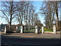
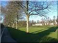
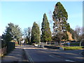
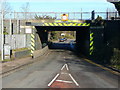
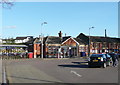
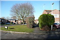
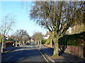
98 photos from this area
Area Information
Key information about the SG5 1QG including its size, population, and administrative classification.
- Area Type
- Postcode
- Area Size
- 6493 m²
- Population
- 2205
- Population Density
- 7301 people/km²
House Prices in SG5 1QG
34
Properties
£324,500
Average Sold Price
£20,000
Lowest Price
£861,500
Highest Price
Showing 34 properties
| Address | Type | Beds | Baths | Last Sale Price | Last Sale Date | |
|---|---|---|---|---|---|---|
| 61A Radcliffe Road, Hitchin, SG5 1QG | house | - | - | £675,000 | Oct 2023 | |
| 12 Radcliffe Road, Hitchin, SG5 1QG | house | - | - | £861,500 | May 2022 | |
| 61 Radcliffe Road, Hitchin, SG5 1QG | Semi-detached | 3 | 2 | £20,000 | Jul 2019 | |
| 59 Radcliffe Road, Hitchin, SG5 1QG | Terraced | 2 | 2 | £340,000 | Dec 2018 | |
| 7 Radcliffe Road, Hitchin, SG5 1QG | Terraced | 2 | 1 | £330,000 | Apr 2018 | |
| 10 Radcliffe Road, Hitchin, SG5 1QG | house | - | - | £360,000 | Nov 2017 | |
| 8 Radcliffe Road, Hitchin, SG5 1QG | house | 3 | - | £274,995 | Nov 2012 | |
| 60 Radcliffe Road, Hitchin, SG5 1QG | Terraced | 2 | 1 | £170,000 | Jan 2012 | |
| 2 Radcliffe Road, Hitchin, SG5 1QG | house | 2 | - | £215,000 | Nov 2011 | |
| 62 Radcliffe Road, Hitchin, SG5 1QG | house | - | - | £250,000 | Jul 2009 |
Page 1 of 4
Energy Efficiency in SG5 1QG
Amenities
Schools
| Rank | School | Type | Entry gender | Ages |
|---|
Explore more schools in this area
Go to Schools tabDemographics
Household Size
One person
most common
Accommodation Type
Flats
most common
Tenure
42
majority
Ethnic Group
White
most common
Religion
N/A
most common
Household Composition
N/A
most common
Age
47
median
Adults (30-64 years)
most common
Household Deprivation
N/A
with no deprivation
NS-SEC
50
in Lower managerial occupations
Explore more demographic insights in this area
Go to Demographics tabPlanning
Planning Constraints
- Flood RiskPremium
- Ramsar Wetland SitesPremium
- Area of Outstanding Natural BeautyPremium
- Protected Nature ReservePremium
- Protected WoodlandPremium