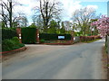
Area Overview for SG4 9BB
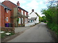
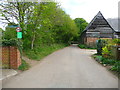
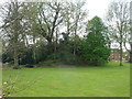
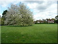
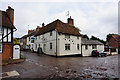
Photos of SG4 9BB
Area Information
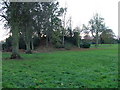
SG4 9BB represents a specific residential cluster in England, defined by its precise postal boundaries rather than traditional village limits. This postcode covers 1.3 hectares and serves a population of 2062 people. Living in this area means engaging with a high-density environment where over 163,665 people reside per square kilometre according to local metrics. You are part of a tightly knit group of homeowners who have chosen this location for its practical advantages. The area functions as a focused residential zone rather than a sprawling suburb, creating a setting where neighbours are inevitably close. Daily life here revolves around the immediate need for efficient transport links and reliable digital infrastructure due to the compact nature of the settlement. Residents navigate this small footprint by prioritising access to major transport hubs and retail centres nearby. The character of SG4 9BB is defined by these logistical realities rather than expansive green spaces or isolated retreats. Homebuyers approaching this postcode should understand that they are stepping into a functional, high-population living space designed for convenience and connectivity. The lack of internal geographical variety means every aspect of your daily routine depends heavily on what lies just beyond the immediate borders. This specificity is a defining feature, not a limitation for those who value clear boundaries and established community structures.
- Area Type
- Postcode
- Area Size
- 1.3 hectares
- Population
- 2062
- Population Density
- 2852 people/km²
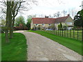
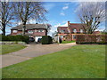
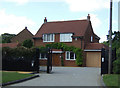
The property market in SG4 9BB is characterised by a decisive skew towards owner-occupation. Data confirms that 88% of homes in this postcode are owned by residents, leaving a very small fraction for private renting. This statistic points directly to SG4 9BB being an established, settled area rather than a transient hub for students or temporary workers. The accommodation type is uniformly houses, meaning you will not encounter apartments or terraced blocks in this specific cluster. This uniformity simplifies the buying process for those seeking standalone family properties or retirement homes. The density of 163,665 people per square kilometre for this 1.3-hectare area suggests land use is intensive but maintained within single-family structures. High ownership levels typically indicate strong local investment and a community resistant to rapid change. For buyers looking at homes in SG4 9BB, the immediate surroundings reflect this same stability. The market here serves those who have already established themselves in the local economy and are looking to secure their future in a permanent residence. The absence of a significant rental stock means competition may be fiercer among local movers but also ensures fewer absentee landlords.
House Prices in SG4 9BB
Showing 6 properties
| Address | Type | Beds | Baths | Last Sale Price | Last Sale Date | |
|---|---|---|---|---|---|---|
| Grassways, Newlands Lane, Hitchin, SG4 9BB | house | 4 | - | £1,375,000 | Mar 2020 | |
| The White House, Newlands Lane, Hitchin, SG4 9BB | house | - | - | £1,695,000 | Oct 2019 | |
| Treetops, Newlands Lane, Hitchin, SG4 9BB | Detached | 4 | - | £1,050,000 | Apr 2019 | |
| Aspen, Newlands Lane, Hitchin, SG4 9BB | Detached | 5 | 2 | £880,000 | Sep 2014 | |
| Oakways, Newlands Lane, Hitchin, SG4 9BB | house | 4 | 2 | £635,000 | Nov 2012 | |
| The Cottage, Newlands Lane, Hitchin, SG4 9BB | Detached | - | - | £685,000 | Jul 2004 |
Energy Efficiency in SG4 9BB
Residents of SG4 9BB benefit from a round of practical amenities located within easy reach across town. You will find five major retail outlets nearby, including M&S Oakfield Hitchin BP, Asda Hitchin, and M&S Hitchin SF. These locations provide comprehensive daily shopping needs without requiring frequent travel to distant city centres. Transport connectivity is exceptional, with five rail options nearby including Hitchin Railway Station, Letchworth Railway Station, and Stevenage Railway Station. These stations offer direct links to wider travel networks, crucial for commuters relying on trains to reach London or other business hubs. Air travel is also convenient, with London Luton Airport situated close by for residents needing frequent flights. This combination of retail giants and major transport nodes creates a lifestyle focused on efficiency and access. The presence of these established brands suggests a neighbourhood designed for self-sufficiency and convenience. Shopping, dining, and transit options are concentrated enough to reduce travel time but varied enough to offer choice. For those living in SG4 9BB, daily errands become simple tasks managed through a compact network of well-known services.
Amenities
Schools
| Rank | School | Type | Entry gender | Ages |
|---|
Explore more schools in this area
Go to Schools tabDemographics
The community within SG4 9BB exhibits a distinct maturity, reflected in a median age of 47 years. Most residents fall within the 30 to 64 years age range, indicating a population dominated by working adults and established families rather than students or retirees. This demographic profile strongly correlates with the area's high home ownership rate of 88%. The vast majority of occupants own their properties outright or with significant equity, suggesting stability and long-term residency. Accommodation throughout this area consists almost exclusively of houses, shaping a neighbourhood built for independent living rather than dense urban blocks. This structure supports a family-oriented environment where private gardens and separate dwellings are the standard arrangement. The predominant ethnic group is White, which aligns with the broader socio-economic patterns often found in stable, owner-occupied housing clusters. With such a high proportion of homeowners, the local culture likely values conservation of property and investment in neighbourhood maintenance. You can expect a quiet, settled atmosphere where residents are invested in the long-term value and safety of their homes. The combination of an older average age, high ownership, and single-family housing creates a predictable and stable daily rhythm for anyone considering living in SG4 9BB.
Household Size
Accommodation Type
Tenure
Ethnic Group
Religion
Household Composition
Age
Household Deprivation
NS-SEC
Explore more demographic insights in this area
Go to Demographics tabPlanning
Planning Constraints
- Flood RiskPremium
- Ramsar Wetland SitesPremium
- Area of Outstanding Natural BeautyPremium
- Protected Nature ReservePremium
- Protected WoodlandPremium