Area Overview for SG4 8AB
Photos of SG4 8AB
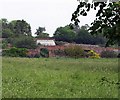
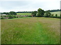
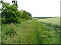
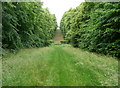
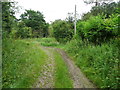
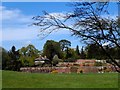
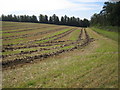
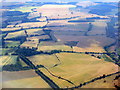
9 photos from this area
Area Information
Key information about the SG4 8AB including its size, population, and administrative classification.
- Area Type
- Postcode
- Area Size
- 1.9 km²
- Population
- 1582
- Population Density
- 73 people/km²
House Prices in SG4 8AB
12
Properties
£490,563
Average Sold Price
£150,000
Lowest Price
£765,000
Highest Price
Showing 12 properties
| Address | Type | Beds | Baths | Last Sale Price | Last Sale Date | |
|---|---|---|---|---|---|---|
| 8 Codicote Road, Whitwell, SG4 8AB | Detached | 4 | 2 | £765,000 | Aug 2025 | |
| 6 Codicote Road, Whitwell, SG4 8AB | Retail | 3 | 2 | £665,000 | Feb 2022 | |
| 2 Codicote Road, Whitwell, SG4 8AB | house | - | - | £525,000 | Sep 2016 | |
| 20 Codicote Road, Whitwell, SG4 8AB | Detached | 4 | 2 | £650,000 | Nov 2014 | |
| 12 Codicote Road, Whitwell, SG4 8AB | Bungalow | - | - | £387,500 | Nov 2012 | |
| 22 Codicote Road, Whitwell, SG4 8AB | Detached | - | - | £627,000 | Jun 2006 | |
| 18 Codicote Road, Whitwell, SG4 8AB | Detached | - | - | £150,000 | Jun 1998 | |
| 10 Codicote Road, Whitwell, SG4 8AB | Detached | - | - | £155,000 | Mar 1997 | |
| 16 Codicote Road, Whitwell, SG4 8AB | Detached | - | - | - | - | |
| 14 Codicote Road, Whitwell, SG4 8AB | Semi-detached | - | - | - | - |
Page 1 of 2
Energy Efficiency in SG4 8AB
Amenities
Schools
| Rank | School | Type | Entry gender | Ages |
|---|
Explore more schools in this area
Go to Schools tabDemographics
Household Size
Family (3-5 people)
most common
Accommodation Type
Houses
most common
Tenure
62
majority
Ethnic Group
White
most common
Religion
N/A
most common
Household Composition
N/A
most common
Age
47
median
Adults (30-64 years)
most common
Household Deprivation
N/A
with no deprivation
NS-SEC
44
in Lower managerial occupations
Explore more demographic insights in this area
Go to Demographics tabPlanning
Planning Constraints
- Flood RiskPremium
- Ramsar Wetland SitesPremium
- Area of Outstanding Natural BeautyPremium
- Protected Nature ReservePremium
- Protected WoodlandPremium