Area Overview for SG4 7TX
Photos of SG4 7TX
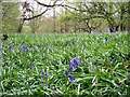
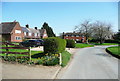
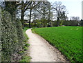
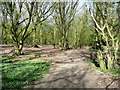
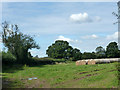
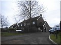
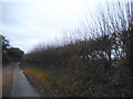
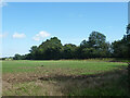
18 photos from this area
Area Information
Key information about the SG4 7TX including its size, population, and administrative classification.
- Area Type
- Postcode
- Area Size
- 8.5 hectares
- Population
- 1077
- Population Density
- 49 people/km²
House Prices in SG4 7TX
32
Properties
£520,000
Average Sold Price
£65,000
Lowest Price
£785,000
Highest Price
Showing 32 properties
| Address | Type | Beds | Baths | Last Sale Price | Last Sale Date | |
|---|---|---|---|---|---|---|
| 5 Chequers Lane, Preston, SG4 7TX | Terraced | 3 | 2 | £690,000 | Feb 2024 | |
| 11 Chequers Lane, Preston, SG4 7TX | Semi-detached | 3 | - | £578,000 | Mar 2019 | |
| 23 Chequers Lane, Preston, SG4 7TX | Semi-detached | 3 | 1 | £407,000 | Dec 2014 | |
| 19 Chequers Lane, Preston, SG4 7TX | Semi-detached | 4 | - | £495,000 | Oct 2014 | |
| Hedgerow, Chequers Lane, Preston, SG4 7TX | house | 4 | 2 | £785,000 | Oct 2012 | |
| Boundary House, Chequers Lane, Preston, SG4 7TX | Detached | 4 | 2 | £520,000 | Apr 2012 | |
| 13 Chequers Lane, Preston, SG4 7TX | Semi-detached | - | - | £400,000 | Aug 2008 | |
| Chequers Cottage, Chequers Lane, Preston, SG4 7TX | Detached | - | - | £740,000 | Jun 2006 | |
| 15 Chequers Lane, Preston, SG4 7TX | Semi-detached | - | - | £65,000 | Mar 1995 | |
| 10 Chequers Lane, Preston, SG4 7TX | Semi-detached | 3 | 1 | - | - |
Page 1 of 4
Energy Efficiency in SG4 7TX
Amenities
Schools
| Rank | School | Type | Entry gender | Ages |
|---|
Explore more schools in this area
Go to Schools tabDemographics
Household Size
Two person
most common
Accommodation Type
Houses
most common
Tenure
69
majority
Ethnic Group
White
most common
Religion
N/A
most common
Household Composition
N/A
most common
Age
47
median
Adults (30-64 years)
most common
Household Deprivation
N/A
with no deprivation
NS-SEC
48
in Lower managerial occupations
Explore more demographic insights in this area
Go to Demographics tabPlanning
Planning Constraints
- Flood RiskPremium
- Ramsar Wetland SitesPremium
- Area of Outstanding Natural BeautyPremium
- Protected Nature ReservePremium
- Protected WoodlandPremium