Area Overview for SG4 0EZ
Photos of SG4 0EZ
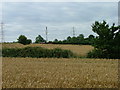
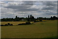
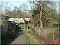
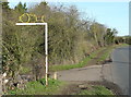
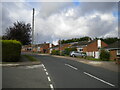
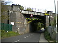
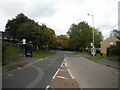
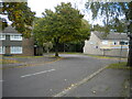
40 photos from this area
Area Information
Key information about the SG4 0EZ including its size, population, and administrative classification.
- Area Type
- Postcode
- Area Size
- 2.5 hectares
- Population
- 1480
- Population Density
- 5098 people/km²
House Prices in SG4 0EZ
58
Properties
£192,851
Average Sold Price
£26,495
Lowest Price
£525,000
Highest Price
Showing 58 properties
| Address | Type | Beds | Baths | Last Sale Price | Last Sale Date | |
|---|---|---|---|---|---|---|
| 39 Talisman Street, Hitchin, SG4 0EZ | Flat | 1 | 1 | £105,000 | Nov 2024 | |
| 35 Talisman Street, Hitchin, SG4 0EZ | Flat | - | - | £123,000 | Oct 2024 | |
| 6 Talisman Street, Hitchin, SG4 0EZ | Semi-detached | 3 | 1 | £430,000 | Jul 2024 | |
| 30 Talisman Street, Hitchin, SG4 0EZ | Flat | - | - | £115,000 | Nov 2023 | |
| 51 Talisman Street, Hitchin, SG4 0EZ | Terraced | 2 | 1 | £320,000 | Aug 2023 | |
| 9 Talisman Street, Hitchin, SG4 0EZ | house | - | - | £440,000 | Feb 2023 | |
| 26 Talisman Street, Hitchin, SG4 0EZ | Terraced | 3 | 1 | £405,000 | Aug 2022 | |
| 19 Talisman Street, Hitchin, SG4 0EZ | house | 3 | 1 | £425,000 | Aug 2022 | |
| 57 Talisman Street, Hitchin, SG4 0EZ | Semi-detached | 3 | 2 | £490,000 | Mar 2022 | |
| 20 Talisman Street, Hitchin, SG4 0EZ | Terraced | 3 | - | £420,000 | Mar 2021 |
Page 1 of 6
Energy Efficiency in SG4 0EZ
Amenities
Schools
| Rank | School | Type | Entry gender | Ages |
|---|
Explore more schools in this area
Go to Schools tabDemographics
Household Size
Family (3-5 people)
most common
Accommodation Type
Houses
most common
Tenure
85
majority
Ethnic Group
White
most common
Religion
N/A
most common
Household Composition
N/A
most common
Age
47
median
Adults (30-64 years)
most common
Household Deprivation
N/A
with no deprivation
NS-SEC
49
in Lower managerial occupations
Explore more demographic insights in this area
Go to Demographics tabPlanning
Planning Constraints
- Flood RiskPremium
- Ramsar Wetland SitesPremium
- Area of Outstanding Natural BeautyPremium
- Protected Nature ReservePremium
- Protected WoodlandPremium