Area Overview for SG3 6PH
Photos of SG3 6PH
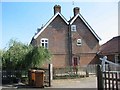
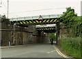
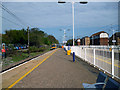
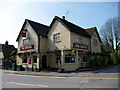
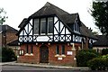
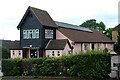
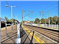
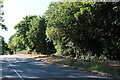
30 photos from this area
Area Information
Key information about the SG3 6PH including its size, population, and administrative classification.
- Area Type
- Postcode
- Area Size
- 2.3 hectares
- Population
- 1886
- Population Density
- 128 people/km²
House Prices in SG3 6PH
24
Properties
£672,558
Average Sold Price
£275,870
Lowest Price
£1,525,000
Highest Price
Showing 24 properties
| Address | Type | Beds | Baths | Last Sale Price | Last Sale Date | |
|---|---|---|---|---|---|---|
| 25 Park Lane, Knebworth, SG3 6PH | Detached | 4 | 2 | £850,000 | Aug 2025 | |
| 30 Park Lane, Knebworth, SG3 6PH | Detached | 4 | 1 | £1,150,000 | Mar 2025 | |
| 31 Park Lane, Knebworth, SG3 6PH | house | - | - | £970,000 | Jul 2019 | |
| 28 Park Lane, Knebworth, SG3 6PH | Bungalow | - | - | £572,000 | Nov 2015 | |
| 38 Park Lane, Knebworth, SG3 6PH | house | - | - | £1,525,000 | Sep 2012 | |
| 59 Park Lane, Knebworth, SG3 6PH | house | 4 | 2 | £580,000 | Feb 2008 | |
| 61 Park Lane, Knebworth, SG3 6PH | Detached | 3 | 1 | £407,000 | Nov 2007 | |
| 53 Park Lane, Knebworth, SG3 6PH | Terraced | - | - | £437,500 | Oct 2007 | |
| 39 Park Lane, Knebworth, SG3 6PH | Detached | - | - | £846,000 | Sep 2007 | |
| 41 Park Lane, Knebworth, SG3 6PH | Detached | - | - | £585,000 | Aug 2002 |
Page 1 of 3
Energy Efficiency in SG3 6PH
Amenities
Schools
| Rank | School | Type | Entry gender | Ages |
|---|
Explore more schools in this area
Go to Schools tabDemographics
Household Size
Two person
most common
Accommodation Type
Houses
most common
Tenure
81
majority
Ethnic Group
White
most common
Religion
N/A
most common
Household Composition
N/A
most common
Age
47
median
Adults (30-64 years)
most common
Household Deprivation
N/A
with no deprivation
NS-SEC
46
in Lower managerial occupations
Explore more demographic insights in this area
Go to Demographics tabPlanning
Planning Constraints
- Flood RiskPremium
- Ramsar Wetland SitesPremium
- Area of Outstanding Natural BeautyPremium
- Protected Nature ReservePremium
- Protected WoodlandPremium