Area Overview for SG3 6BU
Photos of SG3 6BU

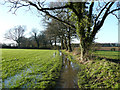
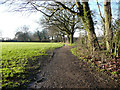
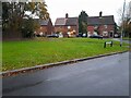
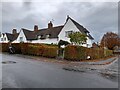
27 photos from this area
Area Information
Key information about the SG3 6BU including its size, population, and administrative classification.
- Area Type
- Postcode
- Area Size
- 1.3 hectares
- Population
- 1886
- Population Density
- 128 people/km²
House Prices in SG3 6BU
44
Properties
£256,417
Average Sold Price
£60,950
Lowest Price
£555,000
Highest Price
Showing 44 properties
| Address | Type | Beds | Baths | Last Sale Price | Last Sale Date | |
|---|---|---|---|---|---|---|
| 84 Orchard Way, Knebworth, SG3 6BU | Detached | 3 | 1 | £435,000 | Dec 2025 | |
| 52 Orchard Way, Knebworth, SG3 6BU | Terraced | 3 | 2 | £510,000 | Oct 2025 | |
| 74 Orchard Way, Knebworth, SG3 6BU | Semi-detached | 4 | 3 | £555,000 | Nov 2024 | |
| 28 Orchard Way, Knebworth, SG3 6BU | Terraced | 2 | 1 | £320,000 | Oct 2024 | |
| 24 Orchard Way, Knebworth, SG3 6BU | Semi-detached | 2 | 1 | £370,500 | Sep 2024 | |
| 40 Orchard Way, Knebworth, SG3 6BU | Terraced | 2 | 1 | £322,500 | Apr 2023 | |
| 60 Orchard Way, Knebworth, SG3 6BU | Terraced | 2 | 1 | £319,000 | Nov 2022 | |
| 18 Orchard Way, Knebworth, SG3 6BU | Semi-detached | 2 | 1 | £415,000 | Sep 2020 | |
| 56 Orchard Way, Knebworth, SG3 6BU | house | - | - | £303,000 | Jun 2020 | |
| 36 Orchard Way, Knebworth, SG3 6BU | house | - | - | £288,000 | Aug 2019 |
Page 1 of 5
Energy Efficiency in SG3 6BU
Amenities
Schools
| Rank | School | Type | Entry gender | Ages |
|---|
Explore more schools in this area
Go to Schools tabDemographics
Household Size
Two person
most common
Accommodation Type
Houses
most common
Tenure
81
majority
Ethnic Group
White
most common
Religion
N/A
most common
Household Composition
N/A
most common
Age
47
median
Adults (30-64 years)
most common
Household Deprivation
N/A
with no deprivation
NS-SEC
46
in Lower managerial occupations
Explore more demographic insights in this area
Go to Demographics tabPlanning
Planning Constraints
- Flood RiskPremium
- Ramsar Wetland SitesPremium
- Area of Outstanding Natural BeautyPremium
- Protected Nature ReservePremium
- Protected WoodlandPremium