Area Overview for SG3 6AL
Photos of SG3 6AL
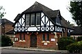
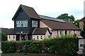
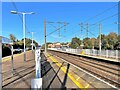
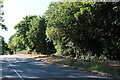
30 photos from this area
Area Information
Key information about the SG3 6AL including its size, population, and administrative classification.
- Area Type
- Postcode
- Area Size
- 1.8 hectares
- Population
- 1850
- Population Density
- 1793 people/km²
House Prices in SG3 6AL
47
Properties
£156,734
Average Sold Price
£49,000
Lowest Price
£255,000
Highest Price
Showing 47 properties
| Address | Type | Beds | Baths | Last Sale Price | Last Sale Date | |
|---|---|---|---|---|---|---|
| 89 Kerr Close, Knebworth, SG3 6AL | Flat | 2 | 1 | £190,000 | Sep 2025 | |
| 41 Kerr Close, Knebworth, SG3 6AL | Flat | 2 | 1 | £190,000 | Jul 2025 | |
| 23 Kerr Close, Knebworth, SG3 6AL | Flat | 2 | 1 | £210,000 | Jun 2025 | |
| 83 Kerr Close, Knebworth, SG3 6AL | Flat | 2 | 1 | £225,000 | May 2025 | |
| 61 Kerr Close, Knebworth, SG3 6AL | Flat | 2 | 1 | £220,250 | May 2025 | |
| 25 Kerr Close, Knebworth, SG3 6AL | Flat | - | - | £252,500 | Oct 2024 | |
| 47 Kerr Close, Knebworth, SG3 6AL | Flat | - | - | £240,000 | Aug 2024 | |
| 35 Kerr Close, Knebworth, SG3 6AL | Flat | - | - | £250,000 | Jul 2024 | |
| 43 Kerr Close, Knebworth, SG3 6AL | Flat | 2 | 1 | £205,000 | Feb 2024 | |
| 9 Kerr Close, Knebworth, SG3 6AL | Flat | 2 | 1 | £255,000 | Jan 2022 |
Page 1 of 5
Energy Efficiency in SG3 6AL
Amenities
Schools
| Rank | School | Type | Entry gender | Ages |
|---|
Explore more schools in this area
Go to Schools tabDemographics
Household Size
Two person
most common
Accommodation Type
Houses
most common
Tenure
70
majority
Ethnic Group
White
most common
Religion
N/A
most common
Household Composition
N/A
most common
Age
47
median
Adults (30-64 years)
most common
Household Deprivation
N/A
with no deprivation
NS-SEC
53
in Lower managerial occupations
Explore more demographic insights in this area
Go to Demographics tabPlanning
Planning Constraints
- Flood RiskPremium
- Ramsar Wetland SitesPremium
- Area of Outstanding Natural BeautyPremium
- Protected Nature ReservePremium
- Protected WoodlandPremium