Area Overview for SG2 9RQ
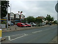
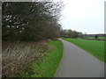
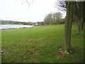
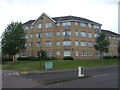
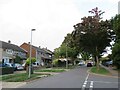
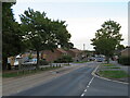
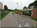
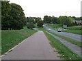
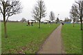
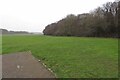
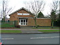
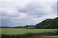
Photos of SG2 9RQ
Area Information
SG2 9RQ represents a small residential cluster within Stevenage, England, defined by specific postcode boundaries rather than a named village or town centre. This area covers just 5257 square metres, making it a compact living space where neighbours are likely within walking distance of one another. With a population of 1463 residents, the neighbourhood maintains a managed scale that avoids the congestion of larger urban zones while offering all the conveniences of a developed community. You will find a settled environment where daily life revolves around local amenities and reliable transport links to Stevenage. The layout is purely residential, focusing on houses that accommodate families and individuals alike. When considering living in SG2 9RQ, you are looking at a location that balancesquiet privacy with access to essential services. The area functions as a neighbourhood unit rather than a standalone town, relying on nearby hubs like Stevenage for major retail and commercial activities. This proximity ensures that while the immediate surroundings are intimate, you remain directly connected to the wider infrastructure of Hertfordshire. Your days here involve a straightforward routine supported by strong digital connectivity and practical access to stations such as Stevenage Railway Station. The compact nature of the postcode means that real estate opportunities are specialised and often reflect the specific needs of the local population.
- Area Type
- Postcode
- Area Size
- 5257 m²
- Population
- 1463
- Population Density
- 5009 people/km²
The property market in SG2 9RQ is characterised by traditional housing stock rather than modern high-density developments. Houses are the main form of accommodation, meaning you will find detached, semi-detached, and terraced properties rather than flats or purpose-built apartments. With 62% of residents owning their homes, the area functions primarily as an owner-occupation zone rather than a rental market. This high ownership rate implies that sellers in SG2 9RQ often include those with generations of ties to the location. Buyers looking for independent living will find their options concentrated in houses that suit families or individuals seeking single-garden lifestyles. The small size of the postcode, covering only 5257 square metres, suggests that new developments are unlikely and the focus remains on the existing housing stock. When viewing homes here, you should expect a mix of architectural styles typical of the region's residential history. The proportion of owner-occupiers often correlates with higher levels of community responsibility and pride in local upkeep. If you are considering purchasing a home in SG2 9RQ, inventory will be limited compared to larger districts, creating a competitive environment for suitable properties. The market dynamics here favour caution and readiness, as new listings may be scarce given the established nature of the neighbourhood.
House Prices in SG2 9RQ
Showing 12 properties
| Address | Type | Beds | Baths | Last Sale Price | Last Sale Date | |
|---|---|---|---|---|---|---|
| 11 Burwell Road, Stevenage, SG2 9RQ | house | - | - | £296,500 | Apr 2024 | |
| 1 Burwell Road, Stevenage, SG2 9RQ | Terraced | 4 | 3 | £395,000 | Mar 2021 | |
| 16 Burwell Road, Stevenage, SG2 9RQ | Semi-detached | 3 | 1 | £295,000 | Jan 2017 | |
| 22 Burwell Road, Stevenage, SG2 9RQ | Terraced | 3 | 1 | £270,000 | Aug 2015 | |
| 14 Burwell Road, Stevenage, SG2 9RQ | house | - | - | £168,000 | Jun 2013 | |
| 9 Burwell Road, Stevenage, SG2 9RQ | house | - | - | £127,000 | Feb 2010 | |
| 5 Burwell Road, Stevenage, SG2 9RQ | Terraced | 2 | 1 | £173,000 | May 2007 | |
| 3 Burwell Road, Stevenage, SG2 9RQ | Terraced | - | - | £170,000 | Oct 2004 | |
| 18 Burwell Road, Stevenage, SG2 9RQ | Terraced | - | - | £148,500 | Aug 2004 | |
| 7 Burwell Road, Stevenage, SG2 9RQ | Terraced | - | - | £145,000 | Nov 2003 |
Energy Efficiency in SG2 9RQ
Daily life in SG2 9RQ benefits from practical access to key amenities within a short drive or commute. Retail options include five outlets such as Co-op Shephall, Sainsburys Stevenage, and Morrisons Daily. These supermarkets and convenience stores ensure you can handle weekly shopping and daily essentials without traveling far. Transport choices are equally convenient, with five rail stations nearby. Stevenage Railway Station, Knebworth Railway Station, and Watton are prominent stops that link the area to the wider rail network. If your morning routine involves grabbing breakfast before work, the local Co-op Shephall offers immediate convenience. Families relying on public transport can rely on the nearby stations to maintain consistent schedules. The combination of major supermarkets and accessible railway stations creates a lifestyle that balances suburban comfort with connectivity. You do not need to travel into a distant city centre for groceries or daily commutes. This arrangement supports a routine where most errands are completed locally or via efficient rail connections. The presence of these specific retailers and stations defines the practical reach of your market area.
Amenities
Schools
Education provisions near SG2 9RQ include three primary schools, reflecting the needs of the local community. Ashtree Primary School and Nursery serves as a primary institution nearby, offering early education for young learners. Collenswood School operates as a primary school, providing another option for families within the vicinity. Ashtree Primary Academy also functions as a primary establishment, contributing to the available educational capacity. All three schools listed in the data are primary institutions, meaning secondary education requires travel to larger hubs outside the immediate neighbourhood. This concentration of primary schools suggests that the local area is well-supported for early childhood and primary education needs. Families living in SG2 9RQ benefit from multiple choices for their children's initial schooling without needing to commute far. The presence of schools in the nearby amenities list reinforces the community's focus on family needs. However, prospective parents should note that secondary schools are not listed within the immediate data, implying they are located further away in Stevenage or surrounding towns. The quality of education delivery at these specific schools would need separate verification through official Ofsted reports, but the geographic presence of these three primary institutions offers convenience for residents.
| Rank | School | Type | Entry gender | Ages |
|---|
Explore more schools in this area
Go to Schools tabDemographics
The community in SG2 9RQ reflects a mature demographic profile, with a median age of 47 years. The most common age range consists of adults between 30 and 64 years, indicating that the area is stabilised rather than experiencing rapid turnover by young people or retirees. This age profile suggests a neighbourhood where residents have settled into long-term homes and established local routines. Home ownership stands at 62%, which is a significant proportion compared to national averages. This high rate indicates that the majority of households own their properties outright or have significant equity rather than being rental tenants. Houses form the predominant accommodation type, confirming that the housing stock is suited to families and those seeking privacy rather than flat dwellings. The predominant ethnic group is White, which aligns with a homogeneous community structure often found in established suburban clusters like this one. Living in SG2 9RQ means joining a group of neighbours who likely share similar life stages and community values. The lack of young children in the median age bracket may influence local demand for primary school places, though actual school enrolment depends on wider local factors. You can expect a stable social environment where long-term residents form the bulk of the local network.
Household Size
Accommodation Type
Tenure
Ethnic Group
Religion
Household Composition
Age
Household Deprivation
NS-SEC
Explore more demographic insights in this area
Go to Demographics tabPlanning
Planning Constraints
- Flood RiskPremium
- Ramsar Wetland SitesPremium
- Area of Outstanding Natural BeautyPremium
- Protected Nature ReservePremium
- Protected WoodlandPremium