Area Overview for SG2 9JG
Photos of SG2 9JG
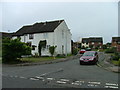
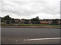
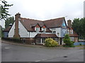
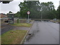
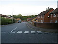
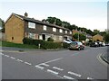
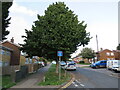
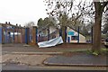
19 photos from this area
Area Information
Key information about the SG2 9JG including its size, population, and administrative classification.
- Area Type
- Postcode
- Area Size
- 5268 m²
- Population
- 1463
- Population Density
- 5009 people/km²
House Prices in SG2 9JG
15
Properties
£149,795
Average Sold Price
£52,000
Lowest Price
£285,000
Highest Price
Showing 15 properties
| Address | Type | Beds | Baths | Last Sale Price | Last Sale Date | |
|---|---|---|---|---|---|---|
| 185 Chertsey Rise, Stevenage, SG2 9JG | Terraced | 3 | - | £285,000 | Feb 2021 | |
| 262 Chertsey Rise, Stevenage, SG2 9JG | Terraced | 2 | - | £169,950 | Jun 2014 | |
| 183 Chertsey Rise, Stevenage, SG2 9JG | house | - | - | £146,000 | May 2013 | |
| 179 Chertsey Rise, Stevenage, SG2 9JG | house | - | - | £147,000 | Sep 2009 | |
| 254 Chertsey Rise, Stevenage, SG2 9JG | house | - | - | £145,000 | Oct 2007 | |
| 256 Chertsey Rise, Stevenage, SG2 9JG | Terraced | - | - | £188,000 | Aug 2007 | |
| 258 Chertsey Rise, Stevenage, SG2 9JG | Detached | 3 | 1 | £155,000 | May 2006 | |
| 244 Chertsey Rise, Stevenage, SG2 9JG | Terraced | - | - | £150,000 | Oct 2004 | |
| 252 Chertsey Rise, Stevenage, SG2 9JG | Terraced | 3 | 1 | £59,995 | Nov 1999 | |
| 250 Chertsey Rise, Stevenage, SG2 9JG | Terraced | - | - | £52,000 | Jul 1997 |
Page 1 of 2
Energy Efficiency in SG2 9JG
Amenities
Schools
| Rank | School | Type | Entry gender | Ages |
|---|
Explore more schools in this area
Go to Schools tabDemographics
Household Size
Family (3-5 people)
most common
Accommodation Type
Houses
most common
Tenure
62
majority
Ethnic Group
White
most common
Religion
N/A
most common
Household Composition
N/A
most common
Age
47
median
Adults (30-64 years)
most common
Household Deprivation
N/A
with no deprivation
NS-SEC
30
in Lower managerial occupations
Explore more demographic insights in this area
Go to Demographics tabPlanning
Planning Constraints
- Flood RiskPremium
- Ramsar Wetland SitesPremium
- Area of Outstanding Natural BeautyPremium
- Protected Nature ReservePremium
- Protected WoodlandPremium