Area Overview for SG2 8ND
Photos of SG2 8ND
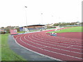
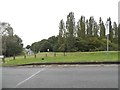
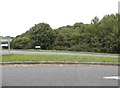
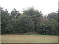
21 photos from this area
Area Information
Key information about the SG2 8ND including its size, population, and administrative classification.
- Area Type
- Postcode
- Area Size
- 7064 m²
- Population
- 1595
- Population Density
- 5496 people/km²
House Prices in SG2 8ND
21
Properties
£160,522
Average Sold Price
£51,250
Lowest Price
£320,000
Highest Price
Showing 21 properties
| Address | Type | Beds | Baths | Last Sale Price | Last Sale Date | |
|---|---|---|---|---|---|---|
| 3 Green Acres, Stevenage, SG2 8ND | Terraced | 3 | 1 | £320,000 | Jun 2025 | |
| 21 Green Acres, Stevenage, SG2 8ND | Terraced | 3 | 1 | £260,000 | Sep 2020 | |
| 29 Green Acres, Stevenage, SG2 8ND | Terraced | 3 | - | £265,000 | Dec 2015 | |
| 9 Green Acres, Stevenage, SG2 8ND | Terraced | - | - | £150,000 | Sep 2008 | |
| 5 Green Acres, Stevenage, SG2 8ND | Terraced | - | - | £137,000 | Mar 2006 | |
| 17 Green Acres, Stevenage, SG2 8ND | Terraced | - | - | £167,000 | Jun 2005 | |
| 8 Green Acres, Stevenage, SG2 8ND | house | - | - | £136,500 | May 2004 | |
| 12 Green Acres, Stevenage, SG2 8ND | Terraced | - | - | £140,000 | Feb 2003 | |
| 6 Green Acres, Stevenage, SG2 8ND | Terraced | - | - | £79,000 | Jul 2001 | |
| 10 Green Acres, Stevenage, SG2 8ND | Terraced | - | - | £51,250 | Jul 1997 |
Page 1 of 3
Energy Efficiency in SG2 8ND
Amenities
Schools
| Rank | School | Type | Entry gender | Ages |
|---|
Explore more schools in this area
Go to Schools tabDemographics
Household Size
Family (3-5 people)
most common
Accommodation Type
Houses
most common
Tenure
69
majority
Ethnic Group
White
most common
Religion
N/A
most common
Household Composition
N/A
most common
Age
47
median
Adults (30-64 years)
most common
Household Deprivation
N/A
with no deprivation
NS-SEC
34
in Lower managerial occupations
Explore more demographic insights in this area
Go to Demographics tabPlanning
Planning Constraints
- Flood RiskPremium
- Ramsar Wetland SitesPremium
- Area of Outstanding Natural BeautyPremium
- Protected Nature ReservePremium
- Protected WoodlandPremium