Area Overview for SG2 7RR
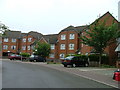
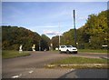
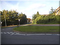
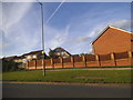
Photos of SG2 7RR


Area Information
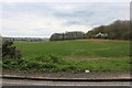
Living in SG2 7RR offers a residential experience defined by stability and established growth within a small cluster. You occupy a specific postcode area that covers just 1508 m², housing 1513 residents in close proximity. This density creates a neighbourhood where community members know one another, yet the setting remains distinctly residential rather than urban. The area is populated primarily by adults aged between 30 and 64 years, reflecting a demographic that often prioritises long-term security and established lifestyles over rapid change. With a population density of 1003176 people per km², the locality feels intimate and familiar. You are part of a settlement where daily life revolves around proximity to neighbours and access to essential services rather than long commutes or vast green spaces. The small footprint of the area means news travels quickly, and local events impact the wider community immediately. This environment suits those who value a grounded, predictable existence away from the fluctuations of larger cities. You find a space that functions efficiently as a home base, connecting you to wider regional networks without sacrificing a sense of rootedness.
- Area Type
- Postcode
- Area Size
- 1508 m²
- Population
- 1513
- Population Density
- 3706 people/km²
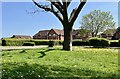
The property market in SG2 7RR is distinctly shaped by a high volume of owner-occupied housing. You will notice that 81% of homes are owned outright or have a mortgage, meaning the local area functions more like a settled residential zone than a high-flux rental market. Houses dominate the accommodation type list, indicating that single-family dwellings form the core of the housing stock within this postcode. This concentration of freehold homes implies that you are buying a piece of a legacy community rather than entering a transient rental arrangement. Prospective buyers looking at homes in SG2 7RR often find a market where vendors are typically existing residents keen on finding their replacement. The prevalence of houses over apartments or flats ensures plenty of indoor and outdoor space for families or empty nesters. You can expect a quiet atmosphere where the primary focus is on residence rather than hospitality or short-term leasing. This structural makeup supports long-term holding strategies for investors and permanent settlements for individuals. The high ownership rate also suggests that local reputations and property conditions have been maintained through years of resident care. You are dealing with a mature market where inventory may move more slowly but offers greater certainty of intent from sellers.
House Prices in SG2 7RR
Showing 2 properties
| Address | Type | Beds | Baths | Last Sale Price | Last Sale Date | |
|---|---|---|---|---|---|---|
| 1, Manor House Drive, Chells Lane, Stevenage, SG2 7RR | house | - | - | £135,000 | Dec 1996 | |
| 2, Chells Manor Lodge, Manor House Drive, Chells Lane, Stevenage, SG2 7RR | office_workshop | - | - | - | - |
Energy Efficiency in SG2 7RR
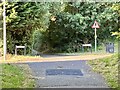
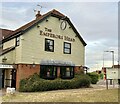
Your daily life in SG2 7RR is supported by a practical ring of amenities located within practical reach of the postcode. Retail needs are met by venues including Tesco Stevenage, Budgens Pin, and Co-op Stevenage. You can access groceries, household essentials, and daily convenience goods without needing to travel far from your home. Public transport is equally accessible, with five notable rail stations serving the area. These include Stevenage Railway Station, Knebworth Railway Station, and Watton. You can commute by train to major regional hubs or connect to wider national networks with minimal fuss. The presence of these major transport nodes means you are not isolated from the rest of Hertfordshire or London. Shopping runs and social meetups become manageable because your local retail and transport infrastructure is strong. You find a balance between needing to drive to larger city centres and having quality options on your doorstep. The mix of supermarkets and railway links provides the flexibility required for modern family life.
Amenities
Schools
| Rank | School | Type | Entry gender | Ages |
|---|
Explore more schools in this area
Go to Schools tabDemographics
The community in SG2 7RR is characterised by a mature adult population, with a median age of 47 years. You will find that the majority of households consist of adults aged between 30 and 64 years, suggesting a demographic well-settled in their professional lives and family structures. Home ownership stands at an impressive 81%, indicating that most residents have purchased their properties rather than renting. This high level of ownership typically correlates with stability and a deeper investment in the local neighbourhood. You live alongside people who are likely concerned with maintaining property values and improving the surrounding vicinity. The accommodation type is predominantly houses, which aligns with the demographic profile of families and multi-adult households seeking space. The predominant ethnic group is White, reflecting a demographic makeup common to many established residential areas in the region. You are surrounded by a community that shares similar life stages and priorities. This concentration of home owners and established households creates a reliable environment where neighbours often look out for one another. The saturation of owner-occupiers suggests a low turnover rate in the local street, offering you a chance to settle into your surroundings without constant displacement.
Household Size
Accommodation Type
Tenure
Ethnic Group
Religion
Household Composition
Age
Household Deprivation
NS-SEC
Explore more demographic insights in this area
Go to Demographics tabPlanning
Planning Constraints
- Flood RiskPremium
- Ramsar Wetland SitesPremium
- Area of Outstanding Natural BeautyPremium
- Protected Nature ReservePremium
- Protected WoodlandPremium