Area Overview for SG2 7JR
Photos of SG2 7JR
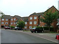
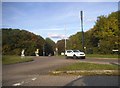
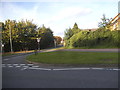
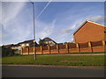
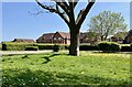
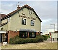
28 photos from this area
Area Information
Key information about the SG2 7JR including its size, population, and administrative classification.
- Area Type
- Postcode
- Area Size
- 2.2 hectares
- Population
- 1498
- Population Density
- 4524 people/km²
House Prices in SG2 7JR
66
Properties
£254,694
Average Sold Price
£71,000
Lowest Price
£585,000
Highest Price
Showing 66 properties
| Address | Type | Beds | Baths | Last Sale Price | Last Sale Date | |
|---|---|---|---|---|---|---|
| 85 Hayfield, Stevenage, SG2 7JR | house | 4 | - | £585,000 | Mar 2025 | |
| 62 Hayfield, Stevenage, SG2 7JR | Semi-detached | 3 | 1 | £430,000 | Feb 2024 | |
| 122 Hayfield, Stevenage, SG2 7JR | house | 3 | 1 | £410,000 | Oct 2023 | |
| 93 Hayfield, Stevenage, SG2 7JR | Detached | 3 | 1 | £435,000 | Aug 2023 | |
| 105 Hayfield, Stevenage, SG2 7JR | house | - | - | £305,000 | Mar 2023 | |
| 61 Hayfield, Stevenage, SG2 7JR | Detached | 3 | 1 | £469,500 | Nov 2022 | |
| 126 Hayfield, Stevenage, SG2 7JR | Retail | 3 | 1 | £460,000 | Sep 2022 | |
| 92 Hayfield, Stevenage, SG2 7JR | Detached | 3 | 1 | £470,000 | Aug 2022 | |
| 103 Hayfield, Stevenage, SG2 7JR | Terraced | 3 | 1 | £370,000 | Feb 2022 | |
| 74 Hayfield, Stevenage, SG2 7JR | Semi-detached | 2 | 1 | £243,000 | Aug 2021 |
Page 1 of 7
Energy Efficiency in SG2 7JR
Amenities
Schools
| Rank | School | Type | Entry gender | Ages |
|---|
Explore more schools in this area
Go to Schools tabDemographics
Household Size
Two person
most common
Accommodation Type
Houses
most common
Tenure
83
majority
Ethnic Group
White
most common
Religion
N/A
most common
Household Composition
N/A
most common
Age
47
median
Adults (30-64 years)
most common
Household Deprivation
N/A
with no deprivation
NS-SEC
40
in Lower managerial occupations
Explore more demographic insights in this area
Go to Demographics tabPlanning
Planning Constraints
- Flood RiskPremium
- Ramsar Wetland SitesPremium
- Area of Outstanding Natural BeautyPremium
- Protected Nature ReservePremium
- Protected WoodlandPremium