Area Overview for SG2 0QU
Photos of SG2 0QU
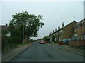
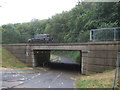
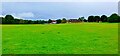
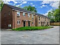
29 photos from this area
Area Information
Key information about the SG2 0QU including its size, population, and administrative classification.
- Area Type
- Postcode
- Area Size
- 1.1 hectares
- Population
- 2178
- Population Density
- 4507 people/km²
House Prices in SG2 0QU
17
Properties
£225,250
Average Sold Price
£114,500
Lowest Price
£341,500
Highest Price
Showing 17 properties
| Address | Type | Beds | Baths | Last Sale Price | Last Sale Date | |
|---|---|---|---|---|---|---|
| 8 Warwick Road, Stevenage, SG2 0QU | Terraced | 3 | 1 | £327,500 | Feb 2025 | |
| 18 Warwick Road, Stevenage, SG2 0QU | Terraced | 3 | 1 | £340,000 | Jul 2023 | |
| 2 Warwick Road, Stevenage, SG2 0QU | Terraced | 3 | 1 | £341,500 | Oct 2022 | |
| 13 Warwick Road, Stevenage, SG2 0QU | Terraced | 2 | 1 | £263,000 | Oct 2019 | |
| 4 Warwick Road, Stevenage, SG2 0QU | house | - | - | £275,000 | Dec 2017 | |
| 3 Warwick Road, Stevenage, SG2 0QU | Terraced | 3 | 1 | £158,000 | Jan 2014 | |
| 9 Warwick Road, Stevenage, SG2 0QU | Terraced | - | - | £149,500 | Mar 2012 | |
| 14 Warwick Road, Stevenage, SG2 0QU | house | - | - | £167,500 | Mar 2010 | |
| 16 Warwick Road, Stevenage, SG2 0QU | house | - | - | £114,500 | Nov 2002 | |
| 20 Warwick Road, Stevenage, SG2 0QU | Terraced | 4 | 2 | £115,995 | Jul 2002 |
Page 1 of 2
Energy Efficiency in SG2 0QU
Amenities
Schools
| Rank | School | Type | Entry gender | Ages |
|---|
Explore more schools in this area
Go to Schools tabDemographics
Household Size
Family (3-5 people)
most common
Accommodation Type
Houses
most common
Tenure
58
majority
Ethnic Group
White
most common
Religion
N/A
most common
Household Composition
N/A
most common
Age
47
median
Adults (30-64 years)
most common
Household Deprivation
N/A
with no deprivation
NS-SEC
28
in Lower managerial occupations
Explore more demographic insights in this area
Go to Demographics tabPlanning
Planning Constraints
- Flood RiskPremium
- Ramsar Wetland SitesPremium
- Area of Outstanding Natural BeautyPremium
- Protected Nature ReservePremium
- Protected WoodlandPremium