Area Overview for SG2 0QH
Photos of SG2 0QH
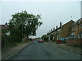
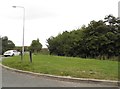
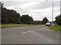
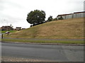
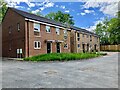
29 photos from this area
Area Information
Key information about the SG2 0QH including its size, population, and administrative classification.
- Area Type
- Postcode
- Area Size
- 5331 m²
- Population
- 2178
- Population Density
- 4507 people/km²
House Prices in SG2 0QH
19
Properties
£231,708
Average Sold Price
£97,000
Lowest Price
£340,000
Highest Price
Showing 19 properties
| Address | Type | Beds | Baths | Last Sale Price | Last Sale Date | |
|---|---|---|---|---|---|---|
| 82 Pankhurst Crescent, Stevenage, SG2 0QH | house | - | - | £340,000 | Apr 2024 | |
| 80 Pankhurst Crescent, Stevenage, SG2 0QH | Terraced | 3 | 1 | £305,000 | Mar 2024 | |
| 72 Pankhurst Crescent, Stevenage, SG2 0QH | Terraced | 3 | 1 | £275,500 | Jun 2020 | |
| 78 Pankhurst Crescent, Stevenage, SG2 0QH | Terraced | 4 | 1 | £330,000 | Jul 2019 | |
| 101 Pankhurst Crescent, Stevenage, SG2 0QH | Terraced | 3 | 2 | £290,000 | Mar 2019 | |
| 68 Pankhurst Crescent, Stevenage, SG2 0QH | Terraced | 3 | 1 | £280,000 | Jun 2016 | |
| 74 Pankhurst Crescent, Stevenage, SG2 0QH | house | - | - | £252,000 | Aug 2015 | |
| 103 Pankhurst Crescent, Stevenage, SG2 0QH | Terraced | 3 | 1 | £160,000 | Nov 2008 | |
| 66 Pankhurst Crescent, Stevenage, SG2 0QH | Terraced | 3 | 1 | £172,000 | Aug 2006 | |
| 86 Pankhurst Crescent, Stevenage, SG2 0QH | Detached | 3 | - | £150,000 | Dec 2005 |
Page 1 of 2
Energy Efficiency in SG2 0QH
Amenities
Schools
| Rank | School | Type | Entry gender | Ages |
|---|
Explore more schools in this area
Go to Schools tabDemographics
Household Size
Family (3-5 people)
most common
Accommodation Type
Houses
most common
Tenure
58
majority
Ethnic Group
White
most common
Religion
N/A
most common
Household Composition
N/A
most common
Age
47
median
Adults (30-64 years)
most common
Household Deprivation
N/A
with no deprivation
NS-SEC
28
in Lower managerial occupations
Explore more demographic insights in this area
Go to Demographics tabPlanning
Planning Constraints
- Flood RiskPremium
- Ramsar Wetland SitesPremium
- Area of Outstanding Natural BeautyPremium
- Protected Nature ReservePremium
- Protected WoodlandPremium