Area Overview for SG2 0JG
Photos of SG2 0JG
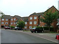
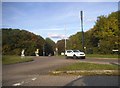
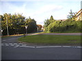
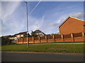
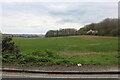
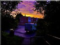
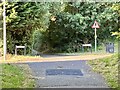
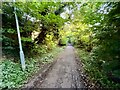
28 photos from this area
Area Information
Key information about the SG2 0JG including its size, population, and administrative classification.
- Area Type
- Postcode
- Area Size
- 1.3 hectares
- Population
- 1498
- Population Density
- 4524 people/km²
House Prices in SG2 0JG
23
Properties
£306,262
Average Sold Price
£86,500
Lowest Price
£585,000
Highest Price
Showing 23 properties
| Address | Type | Beds | Baths | Last Sale Price | Last Sale Date | |
|---|---|---|---|---|---|---|
| 1 Dryden Crescent, Stevenage, SG2 0JG | Detached | 4 | 1 | £585,000 | Sep 2024 | |
| 46 Dryden Crescent, Stevenage, SG2 0JG | Detached | 3 | 2 | £430,000 | Jun 2021 | |
| 9 Dryden Crescent, Stevenage, SG2 0JG | house | - | - | £415,000 | Nov 2020 | |
| 48 Dryden Crescent, Stevenage, SG2 0JG | Detached | 3 | 2 | £420,000 | May 2018 | |
| 7 Dryden Crescent, Stevenage, SG2 0JG | Detached | 4 | 2 | £510,000 | Jan 2018 | |
| 54 Dryden Crescent, Stevenage, SG2 0JG | house | - | - | £525,000 | Jul 2016 | |
| 28 Dryden Crescent, Stevenage, SG2 0JG | house | - | - | £450,000 | Oct 2015 | |
| 38 Dryden Crescent, Stevenage, SG2 0JG | house | - | - | £335,000 | Nov 2013 | |
| 11 Dryden Crescent, Stevenage, SG2 0JG | Detached | 3 | - | £250,000 | Jul 2013 | |
| 5 Dryden Crescent, Stevenage, SG2 0JG | house | 4 | - | £273,000 | Mar 2012 |
Page 1 of 3
Energy Efficiency in SG2 0JG
Amenities
Schools
| Rank | School | Type | Entry gender | Ages |
|---|
Explore more schools in this area
Go to Schools tabDemographics
Household Size
Two person
most common
Accommodation Type
Houses
most common
Tenure
83
majority
Ethnic Group
White
most common
Religion
N/A
most common
Household Composition
N/A
most common
Age
47
median
Adults (30-64 years)
most common
Household Deprivation
N/A
with no deprivation
NS-SEC
40
in Lower managerial occupations
Explore more demographic insights in this area
Go to Demographics tabPlanning
Planning Constraints
- Flood RiskPremium
- Ramsar Wetland SitesPremium
- Area of Outstanding Natural BeautyPremium
- Protected Nature ReservePremium
- Protected WoodlandPremium