Area Overview for SG2 0EY
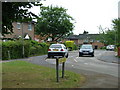
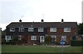
Photos of SG2 0EY


Area Information
Living in SG2 0EY means residing within a compact residential cluster covering just 1,937 square metres. This tiny footprint accommodates 1,751 residents, creating a neighbourhood with a very high population density. You are进入了 a setting defined by its specific postcode boundaries rather than expansive town planning zones. The area sits firmly within England, offering a distinct identity separate from the broader Stevenage or Hertfordshire regions. Daily life here is characterised by close proximity between homes, which fosters an immediate sense of community familiarity. While the physical space is limited, the density ensures that residents are never far from their neighbours. This concentration of households creates a unique micro-environment where local interaction is frequent. Prospective buyers should understand that purchasing a property in SG2 0EY means joining a small, tightly knit group where boundaries are clearly defined. The lack of large open spaces in the immediate vicinity contrasts with the efficiency of urban-style living found in larger postcodes. You will experience a lifestyle where distance to essentials is minimal, but the sheer volume of people per square kilometre is significant. This specific location offers a straightforward introduction to life in this part of the county without the complexity of sprawling suburbs.
- Area Type
- Postcode
- Area Size
- 1937 m²
- Population
- 1751
- Population Density
- 5845 people/km²
The property market in SG2 0EY is defined by a predominantly owner-occupied landscape where houses make up the primary accommodation type. With 63 per cent of homes owned by residents, you are entering a market geared towards buyers seeking security and stability rather than a rental-first environment. The area comprises 1,751 residents packed into 1,937 square metres, creating a focused housing stock typical of a small residential cluster. Most transactions here involve moving between private owners rather than renting from private landlords. This high ownership percentage typically drives competition when properties become available, as locals prefer to buy rather than lease. The accommodation type data confirms that traditional houses dominate the streets, likely offering family-sized spaces suitable for the median age of 47. Buyers looking at homes in SG2 0EY should expect to compete with established owners who do not move frequently. The small footprint of the area limits the total supply of properties, which can create a tight market with potentially less variety compared to larger postcodes. Investors focused on high rental yields may find fewer opportunities here due to the strong preference for ownership among current residents. When evaluating homes in this postcode, consider how the 63 per cent ownership rate influences price resilience and neighbourhood character.
House Prices in SG2 0EY
Showing 24 properties
| Address | Type | Beds | Baths | Last Sale Price | Last Sale Date | |
|---|---|---|---|---|---|---|
| 15, Newhaven, Drakes Drive, Stevenage, SG2 0EY | Flat | 2 | 2 | £145,000 | Sep 2025 | |
| 11, Newhaven, Drakes Drive, Stevenage, SG2 0EY | Flat | 2 | 1 | £162,000 | Feb 2024 | |
| 22, Newhaven, Drakes Drive, Stevenage, SG2 0EY | Flat | - | - | £210,000 | Oct 2023 | |
| 1, Newhaven, Drakes Drive, Stevenage, SG2 0EY | Flat | 2 | - | £215,000 | Sep 2020 | |
| 6, Newhaven, Drakes Drive, Stevenage, SG2 0EY | Flat | 1 | 1 | £178,000 | Feb 2020 | |
| 8, Newhaven, Drakes Drive, Stevenage, SG2 0EY | Flat | - | - | £220,000 | Aug 2019 | |
| 24, Newhaven, Drakes Drive, Stevenage, SG2 0EY | Flat | - | - | £233,000 | Jun 2019 | |
| 3, Newhaven, Drakes Drive, Stevenage, SG2 0EY | Flat | - | - | £230,000 | Nov 2018 | |
| 21, Newhaven, Drakes Drive, Stevenage, SG2 0EY | Flat | - | - | £180,000 | Sep 2018 | |
| 17, Newhaven, Drakes Drive, Stevenage, SG2 0EY | Flat | - | - | £235,000 | May 2018 |
Energy Efficiency in SG2 0EY
Your daily life in SG2 0EY benefits from immediate access to essential retail and transport links within practical reach. Five notable retail venues are nearby, including Tesco Stevenage, Co-op Stevenage, and Morrisons Daily. These supermarkets provide comprehensive shopping options for groceries, household goods, and daily essentials without requiring long journeys. For commuters, rail connectivity is strong with five stations accessible, including Stevenage Railway Station, Knebworth Railway Station, and Watton. Stevenage Railway Station offers direct access to the city, while Knebworth provides a route towards the northern parts of Hertfordshire. This variety of transport hubs ensures you can choose the line that best suits your work or leisure commitments. The presence of Co-op and Morrisons complements the supermarket options, giving you flexibility if one store is busy or full. Walking to Tesco Stevenage or using a local bus link to reach the stations adds convenience to your routine. Retail and transport density supports a balanced lifestyle where errands take little time. You can combine a morning shop at Morrisons Daily with a train commute from Stevenage Railway Station in one efficient day.
Amenities
Schools
Families considering homes in SG2 0EY have one primary school option immediately nearby: The Nobel School. This primary school holds a Good rating from Ofsted, indicating it meets expected standards for education and child care. The presence of a single named school in your immediate vicinity suggests that secondary education or further options may require travel to adjacent postcodes or main towns like Stevenage. The Nobel School serves the local community, providing essential early years education for children living in this postcode. With a population of 1,751, the school catchment area is likely well-matched to the local residential density. Parents should verify current admission zones as boundaries can shift, but The Nobel School stands as the key educational facility referenced for this location. The Good OFSTED rating provides a baseline of quality assurance for your children's learning environment. While only one school is listed in the immediate data, the existence of a primary institution supports the area's suitability for older families. If you are seeking secondary options, you will need to look beyond SG2 0EY boundaries to established schools in wider Hertfordshire. The availability of just one primary school highlights the specialised nature of this small educational cluster.
| Rank | School | Type | Entry gender | Ages |
|---|
Explore more schools in this area
Go to Schools tabDemographics
The community in SG2 0EY is shaped by a mature demographic profile centred on adults aged between 30 and 64 years. With a median age of 47, the area attracts individuals and families past their early twenties but not yet entering senior retirement. Home ownership stands at 63 per cent, indicating that slightly more than six households in ten are owned outright or have a mortgage. This high rate of ownership suggests financial stability and long-term residents rather than a transient rental population. The dominant accommodation type consists of houses, though the small area size implies a mix of housing styles within a confined space. The predominant ethnic group is White, reflecting the broader settlement patterns of Stevenage and surrounding Hertfordshire districts. Given the density of 904,044 people per square kilometre, social interactions likely occur frequently among residents who have established roots in the area. The age profile means you will find neighbours who are likely to stay put, reducing turnover rates. This stability is crucial for building trust within such a dense cluster. Deprivation data is not provided for this specific postcode, but the high home ownership rate and older median age generally point to a settled, financially independent community. Families with working-age adults form the backbone of this neighbourhood, prioritising stability and ownership over temporary accommodation.
Household Size
Accommodation Type
Tenure
Ethnic Group
Religion
Household Composition
Age
Household Deprivation
NS-SEC
Explore more demographic insights in this area
Go to Demographics tabPlanning
Planning Constraints
- Flood RiskPremium
- Ramsar Wetland SitesPremium
- Area of Outstanding Natural BeautyPremium
- Protected Nature ReservePremium
- Protected WoodlandPremium