Area Overview for SG19 3BS
Photos of SG19 3BS

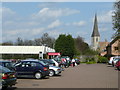
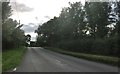
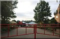
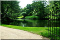
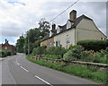
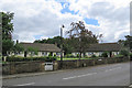
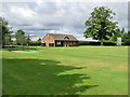
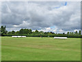
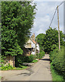
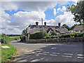
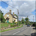
52 photos from this area
Area Information
Key information about the SG19 3BS including its size, population, and administrative classification.
- Area Type
- Postcode
- Area Size
- 17.5 hectares
- Population
- 1685
- Population Density
- 48 people/km²
House Prices in SG19 3BS
15
Properties
£500,500
Average Sold Price
£177,000
Lowest Price
£805,000
Highest Price
Showing 15 properties
| Address | Type | Beds | Baths | Last Sale Price | Last Sale Date | |
|---|---|---|---|---|---|---|
| The Forge, Eltisley Road, Waresley, SG19 3BS | Detached | 3 | 2 | £470,000 | Aug 2017 | |
| Hollybank, Eltisley Road, Waresley, SG19 3BS | Detached | 4 | 3 | £550,000 | Jun 2016 | |
| Waresley Cottage, Eltisley Road, Waresley, SG19 3BS | house | - | - | £805,000 | Jan 2016 | |
| Welford House, Eltisley Road, Waresley, SG19 3BS | Detached | - | - | £177,000 | Nov 2001 | |
| Living Accommodation, Duncombe Arms, Eltisley Road, Waresley, SG19 3BS | Detached | 4 | 1 | - | - | |
| All Weather Practice Net, Waresley Cricket Club, Manor Farm Road, Waresley, SG19 3BS | Leisure | - | - | - | - | |
| Chester's Courtyard, Eltisley Road, Waresley, SG19 3BS | Bungalow | - | - | - | - | |
| 1, The Bank, Eltisley Road, Waresley, SG19 3BS | house | - | - | - | - | |
| The Park, Eltisley Road, Waresley, SG19 3BS | house | - | - | - | - | |
| 2, The Bank, Eltisley Road, Waresley, SG19 3BS | house | - | - | - | - |
Page 1 of 2
Energy Efficiency in SG19 3BS
Amenities
Schools
| Rank | School | Type | Entry gender | Ages |
|---|
Explore more schools in this area
Go to Schools tabDemographics
Household Size
Two person
most common
Accommodation Type
Houses
most common
Tenure
84
majority
Ethnic Group
White
most common
Religion
N/A
most common
Household Composition
N/A
most common
Age
47
median
Adults (30-64 years)
most common
Household Deprivation
N/A
with no deprivation
NS-SEC
52
in Lower managerial occupations
Explore more demographic insights in this area
Go to Demographics tabPlanning
Planning Constraints
- Flood RiskPremium
- Ramsar Wetland SitesPremium
- Area of Outstanding Natural BeautyPremium
- Protected Nature ReservePremium
- Protected WoodlandPremium