Area Overview for SG19 2SL
Photos of SG19 2SL
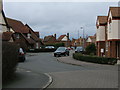
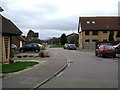
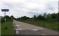
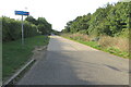

13 photos from this area
Area Information
Key information about the SG19 2SL including its size, population, and administrative classification.
- Area Type
- Postcode
- Area Size
- 1.7 hectares
- Population
- 2471
- Population Density
- 4354 people/km²
House Prices in SG19 2SL
31
Properties
£248,267
Average Sold Price
£157,000
Lowest Price
£409,950
Highest Price
Showing 31 properties
| Address | Type | Beds | Baths | Last Sale Price | Last Sale Date | |
|---|---|---|---|---|---|---|
| 33 Owlswood, Sandy, SG19 2SL | Terraced | 4 | 2 | £372,000 | Jul 2025 | |
| 9 Owlswood, Sandy, SG19 2SL | Semi-detached | 4 | 3 | £343,000 | Nov 2024 | |
| 35 Owlswood, Sandy, SG19 2SL | Terraced | 4 | 1 | £360,000 | Apr 2024 | |
| 23 Owlswood, Sandy, SG19 2SL | Terraced | 4 | 2 | £365,000 | Dec 2022 | |
| 24 Owlswood, Sandy, SG19 2SL | Semi-detached | 2 | 1 | £275,000 | Oct 2022 | |
| 29 Owlswood, Sandy, SG19 2SL | Terraced | 4 | - | £395,000 | Oct 2022 | |
| 19 Owlswood, Sandy, SG19 2SL | house | 2 | - | £176,000 | Aug 2022 | |
| 27 Owlswood, Sandy, SG19 2SL | house | 4 | - | £330,000 | Jun 2021 | |
| 14 Owlswood, Sandy, SG19 2SL | Flat | 2 | 2 | £187,000 | Oct 2020 | |
| 6 Owlswood, Sandy, SG19 2SL | Semi-detached | 4 | 1 | £285,000 | Jan 2017 |
Page 1 of 4
Energy Efficiency in SG19 2SL
Amenities
Schools
| Rank | School | Type | Entry gender | Ages |
|---|
Explore more schools in this area
Go to Schools tabDemographics
Household Size
Family (3-5 people)
most common
Accommodation Type
Houses
most common
Tenure
86
majority
Ethnic Group
White
most common
Religion
N/A
most common
Household Composition
N/A
most common
Age
47
median
Adults (30-64 years)
most common
Household Deprivation
N/A
with no deprivation
NS-SEC
39
in Lower managerial occupations
Explore more demographic insights in this area
Go to Demographics tabPlanning
Planning Constraints
- Flood RiskPremium
- Ramsar Wetland SitesPremium
- Area of Outstanding Natural BeautyPremium
- Protected Nature ReservePremium
- Protected WoodlandPremium