Area Overview for SG19 2QJ
Photos of SG19 2QJ

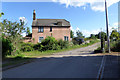
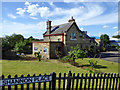
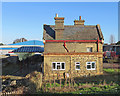
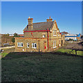
21 photos from this area
Area Information
Key information about the SG19 2QJ including its size, population, and administrative classification.
- Area Type
- Postcode
- Area Size
- 1.4 hectares
- Population
- 2004
- Population Density
- 154 people/km²
House Prices in SG19 2QJ
47
Properties
£178,235
Average Sold Price
£54,995
Lowest Price
£325,000
Highest Price
Showing 47 properties
| Address | Type | Beds | Baths | Last Sale Price | Last Sale Date | |
|---|---|---|---|---|---|---|
| 77 Newtown, Potton, SG19 2QJ | Terraced | 3 | 1 | £291,000 | Mar 2025 | |
| 40 Newtown, Potton, SG19 2QJ | house | - | - | £260,000 | Mar 2024 | |
| 53 Newtown, Potton, SG19 2QJ | Terraced | 2 | 1 | £265,000 | Aug 2023 | |
| 85 Newtown, Potton, SG19 2QJ | Terraced | 2 | 1 | £325,000 | Mar 2022 | |
| 45 Newtown, Potton, SG19 2QJ | Semi-detached | 2 | 1 | £210,000 | Aug 2019 | |
| 71 Newtown, Potton, SG19 2QJ | Terraced | 3 | 1 | £215,000 | Dec 2016 | |
| 83 Newtown, Potton, SG19 2QJ | Terraced | 3 | 1 | £225,000 | Sep 2016 | |
| 42 Newtown, Potton, SG19 2QJ | house | - | - | £160,000 | Nov 2013 | |
| 44 Newtown, Potton, SG19 2QJ | Terraced | 2 | - | £141,000 | Aug 2013 | |
| 70 Newtown, Potton, SG19 2QJ | Terraced | - | - | £103,000 | Dec 2012 |
Page 1 of 5
Energy Efficiency in SG19 2QJ
Amenities
Schools
| Rank | School | Type | Entry gender | Ages |
|---|
Explore more schools in this area
Go to Schools tabDemographics
Household Size
Two person
most common
Accommodation Type
Houses
most common
Tenure
66
majority
Ethnic Group
White
most common
Religion
N/A
most common
Household Composition
N/A
most common
Age
47
median
Adults (30-64 years)
most common
Household Deprivation
N/A
with no deprivation
NS-SEC
38
in Lower managerial occupations
Explore more demographic insights in this area
Go to Demographics tabPlanning
Planning Constraints
- Flood RiskPremium
- Ramsar Wetland SitesPremium
- Area of Outstanding Natural BeautyPremium
- Protected Nature ReservePremium
- Protected WoodlandPremium