Area Overview for SG19 2BE
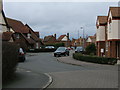
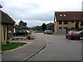
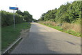
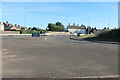
Photos of SG19 2BE


Area Information
Living in SG19 2BE means residing within a specific residential cluster defined by the postcode SG19 2BE. This small area covers 630 square metres of land and is home to 2,471 residents. The population density here is exceptionally high at 392,281 people per square kilometre, which defines the compact nature of this neighbourhood. You are buying into a tightly knit environment where every settlement is close to another. Life in SG19 2BE is characterised by immediate proximity to essential services rather than sprawling suburbs. The area sits in England and functions as a focused residential node. Knowing exactly who lives in SG19 2BE gives you clarity on the community type. This is a place where daily commutes to nearby stations like Sandy or Biggleswade are practical realities. Understanding the scale of SG19 2BE helps you set expectations about space and independence versus convenience. It is a defined postcode area covering a small residential cluster with clear boundaries and a concentrated population. This specificity matters when you evaluate the potential for local community involvement and noise levels. The location offers a direct link to the wider region without requiring long travel times for daily necessities.
- Area Type
- Postcode
- Area Size
- 630 m²
- Population
- 2471
- Population Density
- 4354 people/km²
The property market in SG19 2BE is defined by a distinct lack of rental demand compared to sales activity. With 86% home ownership, this area is overwhelmingly owner-occupied rather than a landlord-investor zone. You are more likely to find family sales here than the typical quick-turnover rental listings found in other regions. The predominant accommodation type comprises houses, which aligns with the high ownership rate and the age profile of residents. This means most homes in SG19 2BE are detached or semi-detached properties suitable for families or downsizers. The market is not driven by investors seeking holiday lets or short-term rentals. Buyers looking at homes in SG19 2BE should expect a traditional market where sellers are often moving to larger properties or retiring. The concentration of houses ensures that you do not find blocks of flats or purpose-built student accommodation. This stability benefits the local estate agent market, as transactions involve substantial equity rather than speculative buying. The area caters to those who value privacy and security over the transient lifestyle of a city centre. If you seek a neighbourhood where owners have invested heavily in their properties, SG19 2BE delivers that specific profile. The market reflects a settled community where real estate is primarily held for long-term family use rather than portfolio yield.
House Prices in SG19 2BE
Showing 1 properties
| Address | Type | Beds | Baths | Last Sale Price | Last Sale Date | |
|---|---|---|---|---|---|---|
| Flat 1, The Local Centre, Kestrel Way, Sandy, SG19 2BE | Flat | - | - | - | - |
Energy Efficiency in SG19 2BE
Your daily lifestyle in SG19 2BE revolves around a small circle of practical, high-quality amenities within walking or short driving distance. There are five retail outlets nearby, including The Southern Co-operative Co, Morrisons Daily Sandy 6, and Co-op Sandy. These shops provide essential groceries and daily necessities, removing the need for extensive shopping trips. For those who do not own a car, the area offers two railway stations: Sandy Railway Station and Biggleswade Railway Station. Access to these stations connects you to a wider network without a long commute to a distant city centre. This blend of local retail and rail transport creates a self-sufficient environment where you can cover most daily needs on foot or by train. You can rely on Morrisons Daily Sandy 6 for fresh produce and The Southern Co-operative Co for weekly budgets. The presence of multiple Co-op branches indicates a strong local high street culture with established businesses. Living in SG19 2BE allows you to maintain a routine that balances local convenience with regional access. There are no large commercial malls, but the selected shops suffice for a domestic household. This arrangement suits the high home ownership rate by supporting a quiet, community-focused shopping experience.
Amenities
Schools
One of the primary educational options available to families living in SG19 2BE is Maple Tree Primary School. This institution is a primary school with an Ofsted rating of good. The presence of this school with a positive rating provides reassurance for parents considering schools near SG19 2BE. There are no secondary schools listed in the immediate data for this specific postcode, meaning families will likely need to look beyond the immediate cluster for older children. The fact that Maple Tree Primary School holds a good rating indicates a standard of education that meets government expectations. You do not have to rely on speculation about the quality of local teaching, as the inspection results are clear. For primary education, this offers a concrete local option without the need for long-distance travel. The data does not include further information on catchment boundaries or waiting lists, so checking with the school directly is advised. However, the single rating provided confirms that local primary education is regulated and monitored to a high standard. Families seeking homes in SG19 2BE benefit from having at least one reputable primary school within reach of their daily routine.
| Rank | School | Type | Entry gender | Ages |
|---|
Explore more schools in this area
Go to Schools tabDemographics
The community in SG19 2BE is dominated by adults between the ages of 30 and 64 years. The median age across the area is 47 years, confirming that families and established households form the core of the local population. Home ownership stands at a high level of 86%, indicating that most residents have purchased their properties rather than renting. This statistic shapes the stability and long-term commitment evident within the neighbourhood. Accommodation in SG19 2BE consists primarily of houses, reflecting a preference for private gardens and standalone structures over flats. The predominant ethnic group is White, which aligns with the broader demographic trends in this part of England. You will find a mature community where many residents have put down roots. This profile suggests a lower turnover of occupants compared to student-heavy or young-professional clusters. The lack of data on deprivation means we rely on age and ownership to understand quality of life. Families with children are likely represented given the age range, though the high median age skews toward older residents. The area is not a university hub but a settled residential zone where people stay for decades. Housing stock consists of houses, matching the needs of those seeking space in an owner-occupied setting.
Household Size
Accommodation Type
Tenure
Ethnic Group
Religion
Household Composition
Age
Household Deprivation
NS-SEC
Explore more demographic insights in this area
Go to Demographics tabPlanning
Planning Constraints
- Flood RiskPremium
- Ramsar Wetland SitesPremium
- Area of Outstanding Natural BeautyPremium
- Protected Nature ReservePremium
- Protected WoodlandPremium