Area Overview for SG19 1RQ
Photos of SG19 1RQ
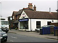
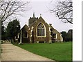

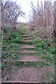
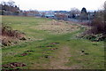

64 photos from this area
Area Information
Key information about the SG19 1RQ including its size, population, and administrative classification.
- Area Type
- Postcode
- Area Size
- 3.9 hectares
- Population
- 1609
- Population Density
- 5529 people/km²
House Prices in SG19 1RQ
82
Properties
£137,511
Average Sold Price
£47,500
Lowest Price
£275,000
Highest Price
Showing 82 properties
| Address | Type | Beds | Baths | Last Sale Price | Last Sale Date | |
|---|---|---|---|---|---|---|
| 222 Winchester Road, Sandy, SG19 1RQ | house | 3 | 1 | £260,000 | Dec 2022 | |
| 178 Winchester Road, Sandy, SG19 1RQ | house | 4 | 1 | £275,000 | Dec 2022 | |
| 206 Winchester Road, Sandy, SG19 1RQ | Semi-detached | 3 | 1 | £168,000 | Aug 2020 | |
| 228 Winchester Road, Sandy, SG19 1RQ | Terraced | 3 | 1 | £196,000 | Sep 2019 | |
| 119 Winchester Road, Sandy, SG19 1RQ | Terraced | 3 | 1 | £198,000 | Dec 2017 | |
| 194 Winchester Road, Sandy, SG19 1RQ | house | 6 | 2 | £208,000 | Sep 2017 | |
| 242 Winchester Road, Sandy, SG19 1RQ | house | 3 | - | £169,500 | Apr 2017 | |
| 202 Winchester Road, Sandy, SG19 1RQ | Semi-detached | 3 | 1 | £173,000 | Jun 2016 | |
| 238 Winchester Road, Sandy, SG19 1RQ | Terraced | 3 | 1 | £147,000 | Jul 2015 | |
| 212 Winchester Road, Sandy, SG19 1RQ | Terraced | 3 | 1 | £155,000 | Jan 2015 |
Page 1 of 9
Energy Efficiency in SG19 1RQ
Amenities
Schools
| Rank | School | Type | Entry gender | Ages |
|---|
Explore more schools in this area
Go to Schools tabDemographics
Household Size
Family (3-5 people)
most common
Accommodation Type
Houses
most common
Tenure
36
majority
Ethnic Group
White
most common
Religion
N/A
most common
Household Composition
N/A
most common
Age
47
median
Adults (30-64 years)
most common
Household Deprivation
N/A
with no deprivation
NS-SEC
18
in Lower managerial occupations
Explore more demographic insights in this area
Go to Demographics tabPlanning
Planning Constraints
- Flood RiskPremium
- Ramsar Wetland SitesPremium
- Area of Outstanding Natural BeautyPremium
- Protected Nature ReservePremium
- Protected WoodlandPremium