Area Overview for SG19 1PE
Photos of SG19 1PE
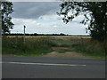
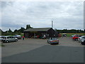
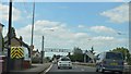
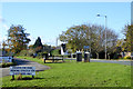
32 photos from this area
Area Information
Key information about the SG19 1PE including its size, population, and administrative classification.
- Area Type
- Postcode
- Area Size
- 1.1 hectares
- Population
- 1488
- Population Density
- 855 people/km²
House Prices in SG19 1PE
9
Properties
£346,356
Average Sold Price
£192,000
Lowest Price
£547,500
Highest Price
Showing 9 properties
| Address | Type | Beds | Baths | Last Sale Price | Last Sale Date | |
|---|---|---|---|---|---|---|
| 23 The Green, Beeston, SG19 1PE | Detached | 4 | 2 | £547,500 | Jul 2025 | |
| 35 The Green, Beeston, SG19 1PE | house | - | - | £350,000 | Jan 2020 | |
| 31 The Green, Beeston, SG19 1PE | house | - | - | £445,000 | Jul 2018 | |
| Threeways, 37 The Green, Beeston, SG19 1PE | Bungalow | - | - | £265,000 | Sep 2011 | |
| 33 The Green, Beeston, SG19 1PE | house | 3 | - | £249,995 | Aug 2010 | |
| 25 The Green, Beeston, SG19 1PE | Detached | - | - | £375,000 | Dec 2005 | |
| 17 The Green, Beeston, SG19 1PE | Semi-detached | - | - | £192,000 | Jul 2004 | |
| 19 The Green, Beeston, SG19 1PE | Semi-detached | - | - | - | - | |
| 21 The Green, Beeston, SG19 1PE | Semi-detached | - | - | - | - |
Energy Efficiency in SG19 1PE
Amenities
Schools
| Rank | School | Type | Entry gender | Ages |
|---|
Explore more schools in this area
Go to Schools tabDemographics
Household Size
Two person
most common
Accommodation Type
Houses
most common
Tenure
88
majority
Ethnic Group
White
most common
Religion
N/A
most common
Household Composition
N/A
most common
Age
47
median
Adults (30-64 years)
most common
Household Deprivation
N/A
with no deprivation
NS-SEC
39
in Lower managerial occupations
Explore more demographic insights in this area
Go to Demographics tabPlanning
Planning Constraints
- Flood RiskPremium
- Ramsar Wetland SitesPremium
- Area of Outstanding Natural BeautyPremium
- Protected Nature ReservePremium
- Protected WoodlandPremium