Area Overview for SG18 9QP
Photos of SG18 9QP
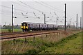
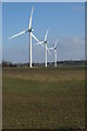
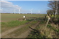
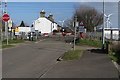
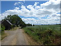
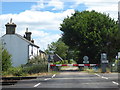
16 photos from this area
Area Information
Key information about the SG18 9QP including its size, population, and administrative classification.
- Area Type
- Postcode
- Area Size
- 1.7 km²
- Population
- 1878
- Population Density
- 581 people/km²
House Prices in SG18 9QP
38
Properties
£220,177
Average Sold Price
£63,400
Lowest Price
£445,000
Highest Price
Showing 38 properties
| Address | Type | Beds | Baths | Last Sale Price | Last Sale Date | |
|---|---|---|---|---|---|---|
| 93 East Road, Langford, SG18 9QP | Semi-detached | 4 | 2 | £445,000 | Feb 2024 | |
| 84 East Road, Langford, SG18 9QP | house | - | - | £320,000 | Jun 2021 | |
| 85 East Road, Langford, SG18 9QP | Semi-detached | 3 | - | £379,000 | Mar 2021 | |
| 94A East Road, Langford, SG18 9QP | Terraced | 2 | 1 | £222,500 | Sep 2020 | |
| 97 East Road, Langford, SG18 9QP | house | - | - | £252,500 | Jun 2019 | |
| 75 East Road, Langford, SG18 9QP | house | - | - | £330,000 | Jun 2018 | |
| 83 East Road, Langford, SG18 9QP | house | - | - | £342,000 | Nov 2017 | |
| 76 East Road, Langford, SG18 9QP | Semi-detached | 3 | - | £327,500 | Apr 2017 | |
| 106 East Road, Langford, SG18 9QP | Terraced | 3 | - | £220,000 | Jul 2016 | |
| 102 East Road, Langford, SG18 9QP | house | - | - | £200,000 | May 2015 |
Page 1 of 4
Energy Efficiency in SG18 9QP
Amenities
Schools
| Rank | School | Type | Entry gender | Ages |
|---|
Explore more schools in this area
Go to Schools tabDemographics
Household Size
Two person
most common
Accommodation Type
Houses
most common
Tenure
77
majority
Ethnic Group
White
most common
Religion
N/A
most common
Household Composition
N/A
most common
Age
47
median
Adults (30-64 years)
most common
Household Deprivation
N/A
with no deprivation
NS-SEC
39
in Lower managerial occupations
Explore more demographic insights in this area
Go to Demographics tabPlanning
Planning Constraints
- Flood RiskPremium
- Ramsar Wetland SitesPremium
- Area of Outstanding Natural BeautyPremium
- Protected Nature ReservePremium
- Protected WoodlandPremium