Area Overview for SG18 9GQ
Photos of SG18 9GQ


Area Information
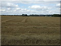
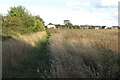
SG18 9GQ defines a specific residential cluster within England, covering an area of 5.7 hectares. With a population of 1409, this small postcode serves as a tightly knit community where residents know one another. The location prioritises quiet living over urban density, offering space for individuals seeking a settled home life. You will find that daily life here revolves around proximity to nearby towns rather than the convenience of being in the heart of a city. The layout supports a lifestyle where residents can walk to local facilities yet remain within easy reach of major transport links. Living in SG18 9GQ means you are part of a defined community with a clear identity. The low population density ensures a peaceful atmosphere, making it suitable for those who value tranquility in their home environment. This postcode is distinct because its residents predominantly own their homes and tend to be middle-aged adults with established careers. You will encounter neighbours who have chosen this spot for its balance of countryside feel and practical connectivity. The area acts as a stable base for families and professionals who prioritise stability over the high energy of a saturated city centre.
- Area Type
- Postcode
- Area Size
- 5.7 hectares
- Population
- 1409
- Population Density
- 95 people/km²
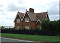
The property market in SG18 9GQ is characterised by a near-total lack of rental properties. With 81% home ownership, the area is dominated by resident owners rather than investors or short-term tenants. This high figure means you will mostly encounter houses that have been maintained by their original or previous families over many years. The accommodation type is strictly houses, indicating a market focused on detached, semi-detached, or terraced residential properties rather than flats or apartments. Buying a home here offers a route into a stable market where price fluctuations often lag behind more volatile urban centres. You are purchasing into a neighbourhood where sellers typically prioritize keeping their home in the same community. This environment reduces the turnover rate and creates a quieter market compared to areas with higher rental yields. If you are looking at homes in SG18 9GQ, you should prepare for a search that emphasizes established estates over new developments. The prevalence of owner-occupied stock suggests that any properties available may have been sold directly from current owners, potentially skipping intermediate estate agent listings.
House Prices in SG18 9GQ
Showing 3 properties
| Address | Type | Beds | Baths | Last Sale Price | Last Sale Date | |
|---|---|---|---|---|---|---|
| 1, Vision Business Park, Preston Place, Upper Caldecote, SG18 9GQ | storage_distribution | - | - | - | - | |
| 18, Vision Business Park, Preston Place, Upper Caldecote, SG18 9GQ | storage_distribution | - | - | - | - | |
| 16, Vision Business Park, Preston Place, Upper Caldecote, SG18 9GQ | storage_distribution | - | - | - | - |
Energy Efficiency in SG18 9GQ
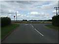
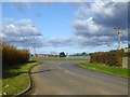
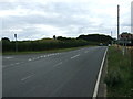
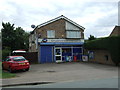
Living in SG18 9GQ offers convenient access to essential retail and transport hubs within a short drive or train ride. You have five major retailers immediately available via the connecting towns, including Sainsburys Biggleswade, Asda Biggleswade, and Iceland Biggleswade. These supermarkets are within practical reach, catering to daily grocery shopping needs without requiring long journeys. Retail availability ensures you can manage household budgets and meal planning efficiently from this postcode. Transport options extend beyond rail, though specific road networks are not detailed, the presence of three railway stations confirms strong regional integration. Biggleswade Railway Station, Sandy Railway Station, and Arlesey Railway Station serve as your primary gateways to wider destinations. Residents benefit from these multiple hubs, allowing flexibility in choosing the best train for work or leisure. The proximity to these stations means you can reach the city in under an hour, blending village life with urban access. You should plan your daily route based on which station matches your destination and schedule best.
Amenities
Schools
Families with children living in SG18 9GQ have access to several educational institutions nearby. Moggerhanger Primary School holds a good Ofsted rating, providing a verified standard of education for younger pupils in the area. You can also reach Northill CofE VA Lower School and Northill CofE Academy, which offer secondary education options for older children. This mix includes both primary and academy-led schools, giving parents a choice of educational philosophies and management structures. Close proximity to these establishments means daily commutes to school are minimal for residents of the postcode. The presence of a primary school with a good rating, combined with near-by academies, creates a supportive network for local families. You do not need to travel to another town for most educational needs in this specific cluster. The variety of school types ensures that different family preferences regarding faith-based, community, or academy education are catered for locally.
| Rank | School | Type | Entry gender | Ages |
|---|
Explore more schools in this area
Go to Schools tabDemographics
The community within SG18 9GQ has a median age of 47, creating an older-than-average population profile. Most residents fall into the 30-64 year age range, indicating a neighbourhood populated by working adults and established families. You will find that stability defines this group, as 81% of households are owned outright or have a mortgage, suggesting strong financial footing among neighbours. The accommodation type is exclusively houses, meaning terraced housing or high-rises are absent from this specific postcode. Diversity exists, though the predominant ethnic group is White. This demographic makeup contributes to a traditional suburban feel where long-term residents form the social backbone of the area. You can expect a community where neighbours often have lived in the same houses for many years, fostering strong local ties. The high level of home ownership reinforces the sense of permanence and investment in the local property market. Families here are likely to value longevity and consistency in their daily lives.
Household Size
Accommodation Type
Tenure
Ethnic Group
Religion
Household Composition
Age
Household Deprivation
NS-SEC
Explore more demographic insights in this area
Go to Demographics tabPlanning
Planning Constraints
- Flood RiskPremium
- Ramsar Wetland SitesPremium
- Area of Outstanding Natural BeautyPremium
- Protected Nature ReservePremium
- Protected WoodlandPremium