Area Overview for SG18 9FP
Photos of SG18 9FP

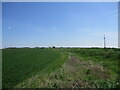
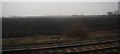
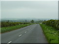
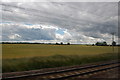

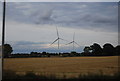
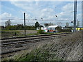
13 photos from this area
Area Information
Key information about the SG18 9FP including its size, population, and administrative classification.
- Area Type
- Postcode
- Area Size
- 1.9 hectares
- Population
- 2255
- Population Density
- 305 people/km²
House Prices in SG18 9FP
22
Properties
£522,946
Average Sold Price
£92,424
Lowest Price
£742,995
Highest Price
Showing 22 properties
| Address | Type | Beds | Baths | Last Sale Price | Last Sale Date | |
|---|---|---|---|---|---|---|
| 17 Campion Edge, Langford, SG18 9FP | Semi-detached | 3 | 3 | £395,000 | Jun 2024 | |
| 19 Campion Edge, Langford, SG18 9FP | house | - | - | £465,000 | Dec 2020 | |
| 5 Campion Edge, Langford, SG18 9FP | house | - | - | £485,000 | Jun 2020 | |
| 23 Campion Edge, Langford, SG18 9FP | house | 5 | 3 | £644,995 | Jun 2019 | |
| 15 Campion Edge, Langford, SG18 9FP | Detached | 5 | 3 | £729,995 | Feb 2019 | |
| 20 Campion Edge, Langford, SG18 9FP | house | - | - | £719,995 | Nov 2018 | |
| 21 Campion Edge, Langford, SG18 9FP | house | - | - | £663,995 | Sep 2018 | |
| 22 Campion Edge, Langford, SG18 9FP | house | - | - | £742,995 | Sep 2018 | |
| 18 Campion Edge, Langford, SG18 9FP | Detached | 3 | 2 | £349,995 | Jun 2018 | |
| 16 Campion Edge, Langford, SG18 9FP | house | - | - | £499,995 | Jun 2018 |
Page 1 of 3
Energy Efficiency in SG18 9FP
Amenities
Schools
| Rank | School | Type | Entry gender | Ages |
|---|
Explore more schools in this area
Go to Schools tabDemographics
Household Size
Two person
most common
Accommodation Type
Houses
most common
Tenure
86
majority
Ethnic Group
White
most common
Religion
N/A
most common
Household Composition
N/A
most common
Age
47
median
Adults (30-64 years)
most common
Household Deprivation
N/A
with no deprivation
NS-SEC
44
in Lower managerial occupations
Explore more demographic insights in this area
Go to Demographics tabPlanning
Planning Constraints
- Flood RiskPremium
- Ramsar Wetland SitesPremium
- Area of Outstanding Natural BeautyPremium
- Protected Nature ReservePremium
- Protected WoodlandPremium