Area Overview for SG18 9DY
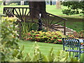
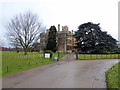
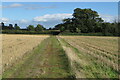
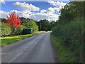
Photos of SG18 9DY


Area Information
SG18 9DY is a small residential cluster in Northamptonshire with a population of 1,508 people. The area is defined by spacious living and low density, with just 42 people per square kilometre. This postcode covers a specific pocket where residents enjoy a quiet, rural feel while remaining close to larger towns. Living in SG18 9DY means accessing the character of the countryside without being isolated from essential services. The community is predominantly settled families, reflected in the area's mature demographic profile. You will encounter neighbours who value privacy and greenery, supported by an environment free from major industrial noise or traffic congestion. The setting is practical for those who prefer a calm routine. Daily life here revolves around nearby towns like Biggleswade for shopping and railway travel. Homes in SG18 9DY offer a connection to the surrounding landscape, making it an ideal choice for those seeking a slower pace. The area maintains its distinct identity as a low-density zone where residents benefit from wide skies and open spaces. It is a location where the simplicity of country living meets the convenience of accessible towns.
- Area Type
- Postcode
- Area Size
- Not available
- Population
- 1508
- Population Density
- 42 people/km²
This postcode is a suppliers of permanent homes rather than short-term rentals. With 49 per cent of households owning their homes, SG18 9DY operates as an owner-occupied area. This high ownership rate contrasts sharply with urban centres where rental listings dominate the market. Houses make up the majority of accommodation, suggesting properties are semi-detached, detached, or bungalows suited to families and retirees. The low population density of 42 people per square kilometre implies generous plot sizes and more garden space compared to high-density developments. Buyers looking at homes in SG18 9DY will find a stock designed for traditional living standards. The presence of owned homes indicates that residents have stayed for the long haul, reducing short-term vacancy rates. This stability enhances the reliability of the local market. When purchasing, you are entering an environment where neighbours are likely long-term residents who know the history of each street. The property market here is not driven by speculative investment but by genuine settlement. Purebred stock includes properties that have weathered decades of use, adding character to the local housing stock. For buyers seeking a home they call their own, this area offers a stable environment.
House Prices in SG18 9DY
No properties found in this postcode.
Energy Efficiency in SG18 9DY
Daily life in SG18 9DY blends rural calm with access to significant retail and transport hubs. You will find three rail stations within practical reach: Biggleswade Railway Station, Sandy Railway Station, and Arlesey Railway Station. These stops allow quick commutes to London and other regional centres. For your weekly shopping, Biggleswade offers Sainsburys, Asda, and Aldi stores. These major supermarkets provide a wide range of groceries without the need for long drives. The retail count of five establishments ensures you have options beyond basic necessities. Dining choices, clothing retailers, and other high-street brands are all accessible within a short journey from your doorstep in SG18 9DY. You do not need to leave the region to satisfy most lifestyle needs. Transport links complement the shopping options, creating a convenient mix of independence and connectivity. Residents enjoy the flexibility of driving to markets in neighbouring towns while also having the option to take trains if preference dictates. The presence of national chains alongside local character maintains a balanced environment.
Amenities
Schools
Families in SG18 9DY have access to quality education nearby, starting with Southill Lower School. This primary school holds a good Ofsted rating, confirming its solid performance in teaching and student welfare. Southill Lower School serves the younger children in the community before they transition to secondary education elsewhere. The presence of a single nearby primary institution indicates that the area caters to young families who value a good start in local education. While the data does not list secondary schools, the proximity of a good-rated primary school suggests that the surrounding community supports families with children up to adolescence. Living in SG18 9DY means your youngest children will likely be educated at Southill Lower School. The school's rating provides reassurance that the local educational infrastructure meets government standards. Parents可以选择 this school for their offspring before moving them to larger secondary institutions in neighbouring towns like Biggleswade or Sandy. The availability of a top-rated primary school adds tangible value to properties in the postcode.
| Rank | School | Type | Entry gender | Ages |
|---|
Explore more schools in this area
Go to Schools tabDemographics
The community in SG18 9DY reflects a settled, family-oriented demographic. The median age is 47 years, indicating that the population is made up primarily of adults aged between 30 and 64 years. Most residents are in their working lives, likely balancing employment in local towns with family responsibilities. Home ownership stands at 49 per cent, meaning nearly half of the households own their property outright or with a mortgage. The other half consists of tenants or shared owners. Houses constitute the predominant accommodation type, reinforcing the character of this quiet stretch of land. Ethnic diversity is highest among white residents, who form the predominant ethnic group within the postcode. This demographic stability suggests a community with deep local roots. The age profile and home ownership rate point towards a neighbourhood comprised largely of established families rather than mobile renters or students. Such demographics often correlate with lower turnover rates and stronger community ties. Residents here are likely invested in the long-term maintenance of their homes and the surrounding environment. The lack of young children in the primary age bracket suggests schools may cater more to teenagers or that families have already moved into secondary education phases in nearby towns.
Household Size
Accommodation Type
Tenure
Ethnic Group
Religion
Household Composition
Age
Household Deprivation
NS-SEC
Explore more demographic insights in this area
Go to Demographics tabPlanning
Planning Constraints
- Flood RiskPremium
- Ramsar Wetland SitesPremium
- Area of Outstanding Natural BeautyPremium
- Protected Nature ReservePremium
- Protected WoodlandPremium